Nepal – Everest Region

Everybody knows the statistics; Everest, also known as Sagarmatha by the Nepalese and Chomolungma by the Tibetans, is the highest mountain on Earth, at 29,028ft or 8848m. First successfully climbed in 1953 by Edmund Hillary and Tenzing Norgay from the British Expedition led by John Hunt, it has now been climbed by around 2,500 climbers. There have also been some 210 deaths on the mountain, or slightly more than one death for every 12 summiteers. A grim reminder that whilst nowadays if you have the money you can virtually buy your way to the top, it is still an extremely hazardous venture.

Everest from the summit of Mount Kala Pattar (5545m).  In the foreground is the Khumbu Glacier, the summit of Everest is the dark peak against the central skyline, with Everest West Shoulder directly in front and Nuptse (7879m), apparently the tallest peak in the picture, because of the perspective, to the right of them. Changtse (7550m) across the border in Tibet, is to the left. Lhotse (8501m) can be glimpsed to the right of Everest, behind Nuptse.


Cairns to climbers who have died on Everest, near Dhugla (Thokla). And a very sobering sight they are, too. Some have plaques, some simple inscriptions, many are anonymous. As you walk further up the Thokla Pass, you look back to this line of cairns on the ridge.


Local transport. A caravan of dzo – a cross between cattle and yaks – pass stone seats provided for travellers. Dzo tend to be both larger and stronger than yaks, an obvious advantage in an animal used for carrying heavy cargoes! They can also go down to lower altitudes than yaks, who are adapted for life at high altitudes.


Traditional door in old house, Khumjung village, near Namche Bazaar.


Inside The temple of Tengboche monastery. Although the temple is beautiful both inside and out, my dominant memories are of sounds – the chanting of the monks at puja, when I sat in the temple one afternoon, completely unable to meditate, since I could not focus on anything except my freezing feet. Also the sounds of the bells, drums and horns that woke me at 7 o’clock in the morning – beats an alarm clock any time!

Entrance to Tengboche Monastery and Temple.


Khumbu Glacier at Lobuche.


Ama Dablam from Khumjung village. In the foreground is one of the schools built by Sir Edmund Hillary, rightly revered throughout the Sherpa community for the huge amount of work that he and his Foundation put into improving the lives of the poor in this area.


Traditional house in Khumjung.


Himalayan Accentor on top of a cairn on Nagartsang Peak . This is a 5083m ‘Trekking’ Peak, ie one that can be ascended without having to use climbing skills. Apparently in America cairns are referred to as ‘ducks’, due to their shapes. So, for American bloggers: Bird on Duck.

Looking down onto the Khumbu Glacier . Although looking rather like a rubble-strewn pathway, in places one can see the bluey-green ice. Here it shows clearly around a glacial lake. As I watched, I could hear the sounds of cracking and splitting as the glacier ground it’s way incredibly slowly downhill.


Yak skull on mani stone with katas (silk scarves) and prayer flags. Cairns are not always simple piles of stones.


Yak train crossing new bridge near Phunki Drengka. The old bridge was washed away.


The old bridge. Testament to the tremendous power of floodwater. 


Khumjung Gompa, where a yeti skull is kept.


The yeti skull.


Sunset, and Ama Dablam appears through the clouds.


Looking south from Dengboche.


The Spirit of the Himalaya.


Moody autumn shot just outside Lukla.


Nuptse (on left) and Everest (on right) at sunset, from Tengboche. In February 2008, when I visited, I saw nothing but clouds and mist. When I returned in October we were treated to the most marvellous sunset and sunrise.


Monks blowing conch shells at morning puja, Tengboche monastery. The monks at the top left hand window are blowing the shells that make a hoarse, trumpet-like sound, during the sunrise puja.


Autumn colours.


Prayer wheels.


Ploughing a field with a wooden, dzo-drawn plough.


Namche Bazaar from above.


Carved Mani stone near Tengboche.

I Could Have Been a Travel Writer

Once (upon a time), I had ambitions to be a travel writer.

I’m sure you know the type;

Just twenty minutes after the wedding vows have been exchanged, the long-suffering partner agrees to the explorer high-tailing it out of the conjugal nest for a couple of years, so that they can retrace the steps of some medieval alchemist-poet-knight who drove three thousand goats across six mountain ranges, converted four heathen princes to the True Faith, and conquered Alsace and Mordor on the way.

signpost (2)

Unfortunately, I quickly decided that I was unlikely to ever have the experience to write a travel book. I have never met the Dalai Lama, interviewed an Imam in a mosque in the mountains of Persia, or chatted intimately to local leaders in remote places. I have met very few people in the aid sector, people who have done particularly brave or daring things, or celebrities.

Indeed, I’m not even a celebrity myself, which seems to be a good travel opening nowadays. I’ve never had the resources to spend years at a time living with villagers in remote Angolan jungle clearings, and I’ve not been able as yet to persuade any large companies to sponsor my meanderings.

And this is a great shame, because travelling and getting paid for it is an attractive proposition. I rather got the appetite for it in the years that I worked abroad. Oh sure, most of my time was spent working, but I did get to travel around and see much that I would never had had the chance to see otherwise. In the 1980’s, Oman was pretty well closed to western visitors, other than those like myself who worked there. It was my first real taste of a society that was very different to my own, in a climate also far removed from anything I had experienced before. I loved it, and I got paid well for it.

It did, unfortunately, instil a slight expectation that I could continue to experience this as long as I wished, and like all good things, it came to an end.

Now, when I do travel, I keep a journal. On the other hand, so do most other travellers. And it only takes a quick glance through mine to see that there is not the basis of a best-selling travel book there. It does sometimes seem that to read most published accounts of journeys, unless they were accomplished with the maximum amount of discomfort then they don’t count. Certainly, I’ve had a few uncomfortable long distance bus rides, been too cold or too hot at times, and passed the odd night in some pretty crap hotel rooms, but I don’t think that’s enough to fill a best seller.

On the other hand, I’ve never set off with just a passport and a change of underwear to travel single-handedly across the amazon jungle, or attempted to unicycle around the Mongolian plateau juggling a bowling ball, an egg and a carving knife, so maybe it is my attitude that is at fault.

But I have a plan!

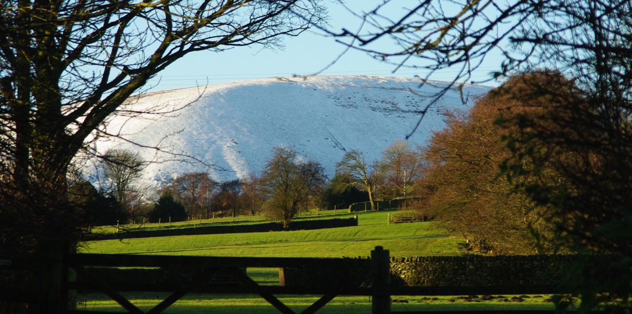
I shall daringly attempt a five mile walk through the English countryside, non-stop and all by myself! No support team, no camera crew, no convenient lift for when the going just gets too hard to bear. There will be nothing other than my own courage and steely determination to get me through the ordeal, except for the prospect of a cold beer at the end of the trail, possibly a pub sandwich and a short ride home on the bus.

I’ve got waterproofs (just in case), a bottle of water, a map, a few snacks, my notebook and camera (for interviewing any gnarled old villagers that I might happen across) and a mobile phone just in case I find myself in any situation that I cannot talk or buy my way out of.

And so, having persuaded my beloved to give me leave of absence for the time it takes me to complete the expedition, I’m off into the comparative unknown.

If this is my last blog post, you’ll know it all went horribly wrong.