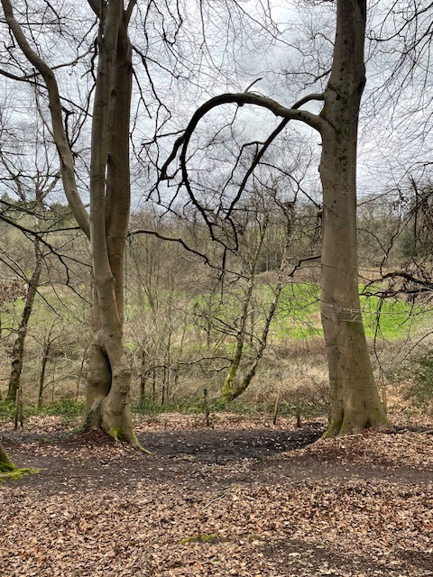
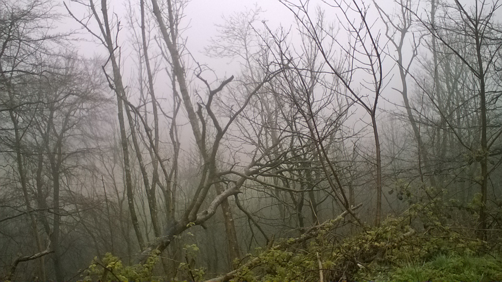
I’ve not done any writing, recently. Partly, it’s family issues keeping me busy, and partly a, well, disinclination to do any writing at the moment. But I’ve been walking and reading, when I’ve had the time, and had the occasional beer with friends. This afternoon I took a walk through the woods nearby. They’re nothing special, in the sense that there are many other patches of woodland like them, although they’re all special, really. I just enjoyed being there.
But having said I’ve been disinclined to write, I’m looking forward to getting stuck into writing a new novel shortly. Don’t get too excited, though, if the last one is anything to go by it’ll be ten years before it’s finished. But there will be trees and darkness, a bit of the occult, and who knows what else. A hero, I suppose. I guess there has to be one of those. Or maybe a heroine instead.
We’ll see. I’m hoping the walking and reading and beer will inspire me.
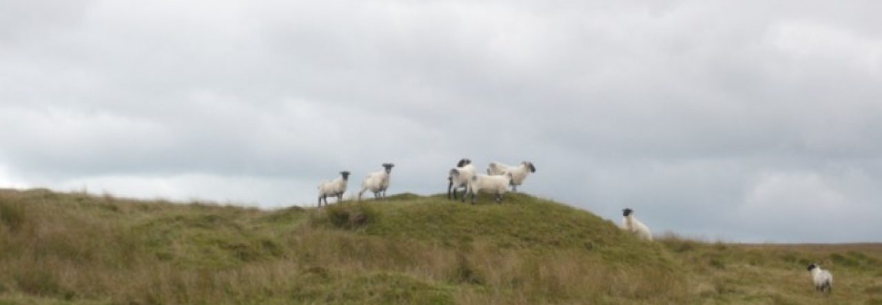
Nothing special…
At certain times of the day the woods are quiet, the dog walkers back home, and that’s when I prefer to go out.
There was plenty of birdsong, lots of birds out. Nothing special, but again they’re all special. Blackbirds, robins, blue tits, a raven…I walk past the portal to a nether world – I always speed up a bit here – then head towards the stream. I have no aim other than to eventually return home.
And as the German poet Novalis said, we are always going home.
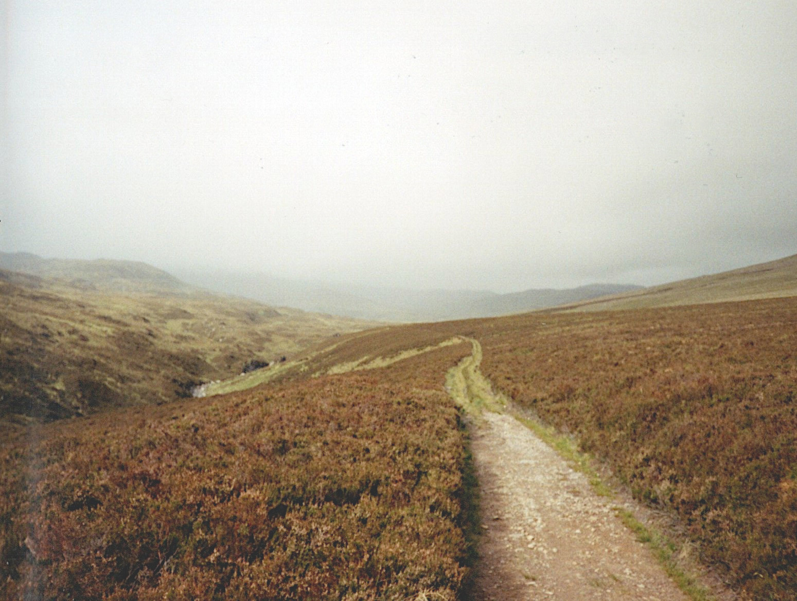
It was a long way to Colmenar. I was walking up into the Malaga Mountains, with no map and no directions other than a road sign at the edge of Malaga suggesting that by following this road I would eventually reach my destination.
I suspect I have undertaken other journeys where I have been better prepared.
But the day was perfect for walking, with high drifting clouds and a light breeze to keep me cool, and having done little for several days other than eat, drink and wander around Malaga, I was feeling fit, fresh, and eager to get going.
As the hours went by and I slowly gained height, the clouds began to build up, and the temperature gradually dropped. About an hour from my destination, it finally began to rain. Immediately the temperature plummeted, and I rapidly went from merely chilled to decidedly cold.
Usually, we approach rain all wrong. Buddhists would say unskilfully. If it begins to rain, we hunch ourselves up, both physically and mentally. We fear becoming cold and wet. We need to let go of this fear. It’s a good lesson to learn. Stop. Take several long, slow, deep, breaths, and let go of this feeling. Let go of this need. We act as though hunching ourselves up will keep us dry and make us warmer. It doesn’t. Unless one can find shelter, it is better to accept the rain and finish the journey.
It is a cliché to speak of heightened awareness, yet that is also a by-product of this letting go. We remove our focus from the rain and instead allow it to go elsewhere, where it is really needed. We should throw back our heads and embrace the rain, enjoy the freshness of the rain on our faces. Listen to the sound of the rain on the ground and the leaves around us.
Back then, I hadn’t learned that lesson. I hurried towards the town as fast as I could.
One of the first buildings I came to was an inn. I went into the bar and asked for a room. The room I was given was reached by leaving the bar again and walking around the side of the building. The door to my room had a gap at the bottom of an inch or two, but otherwise fitted the door frame well enough. It was locked and unlocked by the type of huge key frequently described as a jailor’s key. The room was furnished only with a bed, a chair, and a small chest of drawers. There was a mirror above the chest of drawers and a crucifix above the head of the bed, but other than those the whitewashed walls were bare. There was a small window which was shuttered. The floor was of flagstones, with no carpet or mat. To use toilet or bathroom it was necessary to leave the room again and continue still further around the building to reach a very basic room. But again, it was clean. And there was a toilet that worked, and a sink with a cold tap. There was also a shower set into the ceiling I could have braved, but it felt much too cold for that.
Later, I would occupy rooms like this in many other places, in many other countries. Simple, perfectly clean, and usually very cheap. I am not sure whether it is because they appeal to the minimalist in me, but in many ways I prefer them to more comfortable accommodation.
Whenever I have stayed in one, I have always felt I was carrying too much baggage with me. I have been beset with the feeling I should be throwing out some of the items I have in my bag – do I need all those clothes? All those other items? It has been a recurring regret of mine that I have never managed to live a simpler lifestyle than I have. I have never enjoyed the frenetic hurry and clamour of modern urban life, and I hate how easily my life can become complex and filled with what feels like unnecessary fuss.
Here, even the spartan contents of my rucksack seemed too much. Perhaps I had too many books with me…
But now I was here, I changed out of my wet clothes and opened the shutters so I could look out at the low cloud and misty horizon. The rain drummed comfortingly on the roof and I settled down to read a book for an hour or so. I was content, and that’s a good place to be.
I cannot remember what I had for supper that night, but I do remember I drank a bottle of cheap red wine with it. Perhaps that is the reason.
I rather think I slept well, too.
And as in all good stories, the morning dawned bright and clear, the sun shining low in a clear blue sky. Before I left the town, I passed a couple of shops and bought a few items for my lunch: bread, a huge tomato, a hunk of cheese, a couple of apples, a bottle of cheap wine.
With the improved weather, and the fact I had more downhill stretches that day than uphill ones, I allowed myself the luxury of returning to Malaga slowly, including a stop for lunch of about an hour. Compared to the UK, Spain is a large country and the rural population is comparatively small. Although I was not far from the city, I saw almost no one else on my walk and I meandered along slowly through a mixture of low trees and bushes, many of them in flower – the distinctive Mediterranean maquis vegetation – rocky outcrops and clumps of flowers, and the occasional lone farmhouse. The ground was dry and dusty, as though the rain of the previous day had never happened, and the sun was hot. With my lunch consisting of about half a bottle of wine as well as the food, I was feeling extremely weary and footsore when I reached Malaga again. I found the hotel I’d stayed in before and got a room on the same floor. After showering, I finished the bread and cheese and decided all I wanted to do was read my book for a while and then have an early night.
There was a knock at the door and when I opened it Matthias was standing there grinning.
It is certainly much harder to learn a foreign language when you get older. Since we’d like to do some more European travel (in my case, especially Spain) I’ve been trying to polish up my Spanish, but seem to be making very slow progress.
But I said I would re-blog the occasional post so here’s one from 2020 about a walk I took in Spain back when I was young and a hell of a lot fitter than I am now:
It wasn’t my first trip to Spain, although it was a long time ago now. I walked into Malaga with a rucksack on my back and followed the signs for ‘Centro’ until I found myself in the crowded central district of older narrow streets with three- and four-story shops and cafes, guest houses and cheap hotels. The second hotel I tried offered me a perfectly adequate room on the third floor at a very good price.
The hotel was old. The wooden floors of the corridors were worn and polished by the passage of countless feet, and everywhere seemed gloomy. It gave the impression of having more nooks and corners where light never penetrated than it should. But the only light came from the occasional bulbs hanging from the ceilings, and other than by returning to the street, the visitor would only encounter daylight once they had reached their room and opened the curtains.
The bed was old, and sagged a good deal more than it should, and the furniture was so dark with age it was difficult to make out the grain. As a base for a few days, I decided it would suit me fine. As I unpacked and settled in, I suddenly heard a violin being played. It sounded quite close, and I opened my bedroom door to investigate. I had just decided the sound was coming from a neighbouring room when it stopped, and then a door opened. A man about ten years older than myself emerged and stopped when he saw me.
‘I’m sorry,’ he said. ‘Did I disturb you?’
He introduced himself as a German who I shall call Matthias, although I am no longer certain that was his name, and who immediately invited me to go for a beer.
It would have been rude of me to refuse.
Matthias was meandering around Europe, he told me, and supporting himself largely by busking. Later that week I was to see him playing in the street and be surprised at just how many passers-by threw coins into his hat. It seemed a particularly enjoyable way to travel. Over those beers and then over a few more later in the week, we talked travel and philosophy, music and religion. When I meet someone while travelling, I find it interesting how I often have less constraint than I would when I meet someone for the first time in more familiar surroundings. Frequently, I will reveal things about myself I would never dream of doing to someone I meet perhaps for the first time at a friend’s house, or at my writing group. I presume it is the unspoken knowledge we will never meet again.
Beside the entrance to the hotel was a little café where I made it my habit to take a breakfast consisting of strong coffee, sometimes with slices of thick white bread dipped in olive oil, sometimes with fried eggs. It was a good place to sit and watch Malaga waking up. Its clientele were a broad mixture of workers all grabbing a quick breakfast on their way to office, shop or building site. Mostly they sat in silence, reading the morning paper and smoking, other than to give their orders to the waiter. On the bar a tiny transistor radio chattered away in speech too indistinct for me to make out more than the occasional word. In a way, though, that only added to the atmosphere. Despite it being a familiar situation, there was enough of the unfamiliar and the foreign to make it feel a little exotic.
I wanted adventure, I wanted to explore. I’ve wanted to do that for as long as I can remember. I travelled in those days with a few changes of clothes in a rucksack and a minimum of half a dozen paperbacks, which invariably included something by Hermann Hesse and at least one poetry book.
That, at least, hasn’t changed much.
I liked to travel light (other than the books, of course), so I had no camera with me and probably very few of the essentials most people would think to take on a Spanish holiday. No swimwear, for example. I don’t do beaches, at least not in that way.
But I had come to Malaga because I had a peripatetic nature, and my itchy feet were troubling me. After a few days I decided to take a walk out to the little town of Colmenar, to the north of the city. I would take a room there for one night and return to Malaga the following day. Any other destination would have done just as well; the purpose was the journey, and the journey was the purpose. I chose this route simply because while wandering around the outskirts of Malaga I saw a narrow road winding up into the hills with almost no traffic on it, signposted to Colmenar. The morning after I had made the decision, I packed my rucksack and checked out of my hotel immediately after breakfast.
Once, I thought I’d write a footpath book, a guidebook for an area I walked frequently and knew well. As well as the practicalities of walking the paths – pointing out turnings that were easy to miss, alternative routes, the geography of the paths – I would also discuss the history and geology of the area, the wildlife and architecture, the folklore…
I’m sure you’ve seen plenty of examples of these books.
But that, naturally, would require me to walk each path carefully noting every point at which I would need to remark on these details. But I know me. I would be coming up to a point where I knew I needed to take note of the vagaries of the route, or points of special interest, and then a mile or two later I’d realise I’d been working on a poem in my head and had forgotten all about the task in hand….I would just find it impossible to keep my focus on the technicalities while walking. And I don’t really do technicalities very well, anyway.
And to have to do this for every step of every part of these routes, well, it’s not what I do. While walking, I’m inclined to drift along, my mind wandering, my focus flitting from one thing to another – whatever catches my eye at the time.
It will just have to go down as another of my discarded projects. The footpath book is for someone else to write.
It is windy this morning and the forecast is for rain and high winds later in the day. Consequently, I go out for a walk straight after breakfast, heading for the woods beside the common where I know I will be sheltered from the worst of it, should the winds get up soon. Above, the clouds are thick and dark and what light does make it through the mirk is thin and silvery, glittering coldly on leaves and puddles, the latter wrinkled with tiny wavelets scurrying in bursts across their surfaces.
A couple of rooks are calling irritably overhead, buffeted by the breeze, as I reach the edge of the wood. A few paces in, I pass along the edge of a shallow, long-disused sandstone quarry, its banks perforated with badger holes, and with other entrances deeper into the woods. The whole of the sett appears to occupy upwards of a fifth of an acre, although there may well be entrances I have not yet found.
Moving on, I find I am walking to the rhythm of a tune in my head, something that happens to me frequently. This time, it is a track from an album by Stick in the Wheel, a kind of punk-folk group, the track being the Abbots Bromley Horn Dance. Stick in the Wheel are a group I have only recently discovered, and the only album I have of theirs (so far!) gets played rather a lot. This particular tune has a very pronounced beat and I wonder, as I often do, whether the tune has come into my head as the beat matches my pace, or whether I have unconsciously altered my pace to fit the tune.
I also decide it doesn’t matter which it is.
It is still early enough in the day for there to be very few other people about. In about an hour’s time the air will be filled with barking and shouting as the regular dog walkers invade, but for now I have the place almost to myself.
I have just begun to re-read Robert MacFarlane’s The Old Ways, and in this he tells us that at the time of writing (2012) he reckoned he had walked perhaps 7,000 or 8,000 miles along footpaths in his lifetime. Does this mean each mile is a unique mile, in that he means he has walked this distance all along different routes, or does it include the day to day walks along local routes, routes such as the one I repeat day after day? He doesn’t make that clear, and I would guess it includes all repetitions. He then goes on to quote De Quincy saying that Wordsworth walked a total of 175,000 – 180,000 miles in his lifetime (although how did he know?), which would clearly include his repeated local walks, if true. I wonder how many I have done and make a vague stab at guessing a figure. At various times I have worked out I tend to walk an average of 20 miles a week, allowing for good and bad periods of walking, of which probably one half would be on footpaths. There were times when I did much less, and times when I did much more, but it seems a reasonable estimate. That would give me a figure of between 25,000 and 27,000 miles in my adult life so far, which is probably wildly out but is quite similar to Robert Macfarlane’s.
I’ve no idea what to conclude from that.
But I know I would probably walk quite a bit further if I didn’t tend to stop so frequently just to stand and stare at my surroundings. I do it often enough to sometimes irritate those I walk with, although they’re usually kind enough to say nothing about it. But there are also those who just get their heads down and walk, walk, walk, seemingly on some mission to cover as many miles as possible in the shortest possible time, barely able to glance around them as they go. What is that about, unless it’s some sort of charity event and they’re raising money by the mile? Where is the pleasure?
The Welsh poet W H Davies wrote ‘What is this life if, full of care, we have no time to stand and stare?’
What indeed?
I’ve been doing it quite a lot again this morning. It seems so important. Surely everyone must do it to a degree?
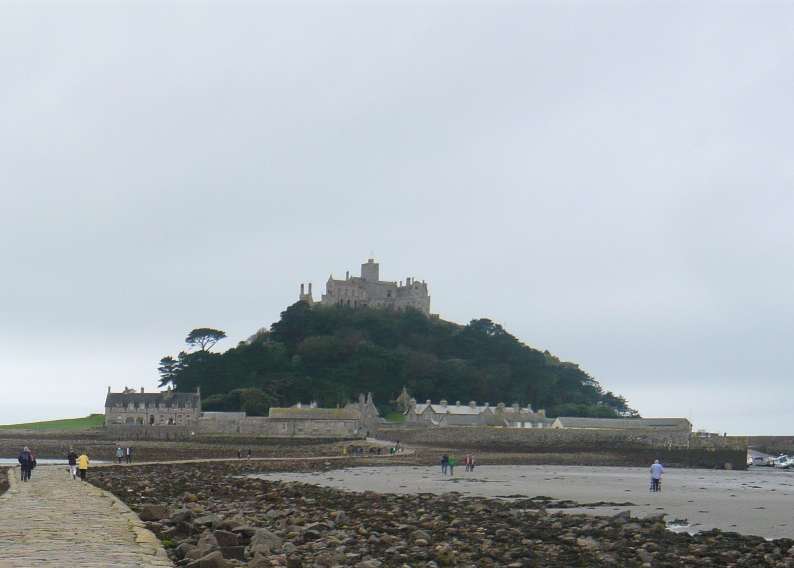
We recently returned from a week in Cornwall, and where we stayed was close to the end of a pilgrim route, St Michael’s Way. This is a short twelve and a half mile walk from the North Cornish coast to St Michael’s Mount, in Mount’s Bay on the South coast. Although the route is such a short one – a day’s walk for most people – it still apparently qualifies for a pilgrim ‘stamp’ on the official pilgrim passport for the very much longer long-distance Camino pilgrimage, since in the Middle Ages many pilgrims walked this route to the Benedictine monastery on the island, then took a boat to France to continue on towards Santiago de Compostela.
I am interested in learning – as far as it is possible for the staunchly non-religious person to learn – what the religious get out of pilgrimages. In the past, they were generally viewed as a way of gaining merit, of putting a few points in the bank when it came to whether you were headed for heaven or hell in the afterlife. Frequently, they were also undertaken in the hope of cures from diseases; various remnants of saints such as bones or clothing were held to have miraculous properties, and the touch of these might cure whichever disease ailed you.
Personally, I view pilgrimage as a spiritual thing, rather than a religious one. Something that puts the pilgrim in touch with their ‘finer’ feelings – a way of understanding what is important in life; relationships, simplicity, art maybe, minimal possessions – we will all have a different interpretation of this. In the past I have considered attempting one of the Camino routes – through France and Northern Spain to Santiago de Compostela. These are long, serious, routes, hundreds of miles long. Had I done so, I would have walked these for pleasure, as well as a personal challenge, rather than as a pilgrimage. Now, though, I am curious to see how much of the ‘religious’ experience I might have.
Whether visiting a church or a standing stone, a ‘holy’ well or a Sufi shrine, all are invested with spirituality. All are invested with meaning to many people and although I know I will never be able to experience the feelings of, say, a Christian at a site they consider holy, I might experience something akin to it. I’m not suggesting I might feel awe at the shrine of a saint, more that I might get an impression of the feelings of the visitors who do. And because I cannot quite find the words to express what I might hope to find, I reckon that’s an indication it’s an experiment worth making.
That’s why you haven’t heard from me for a while. Here’re a few pictures.
We began walking from Amberley this time, and on the first day the weather was pretty meh. It was either raining or starting to rain or just deciding when to rain. But, as always, the Downs looked fantastic. This view reminded me of a Roland Hilder painting:
But it got steadily wetter throughout the day. We took a very welcome break in the Frankland Arms in Washington and if I was writing a pub review it would get five stars – especially as it served Harvey’s Old Ale. But I only allowed myself one of those, as we still had some serious mileage to do. And it was, as noted, getting wetter. We approached Chanctonbury Ring:
And as we began the descent from the top, the saddest part of the journey. We walked among a large number of ash trees, all of which were dead or dying from Ash Dieback disease. It looked like a picture of the Somme.
The next day was dull, but at least it was dry. We walked past the Devil’s Dyke which I never seem to be able to get a good picture of, no matter which angle I take it at. The Devil’s Dyke is so-called because for some reason the Devil wanted to destroy Sussex, and got talking to Saint Dunstan and asked him the best way to do it. Why he did that I can’t imagine. Never ask a saint for advice if you’re the Devil. It won’t end well. Anyway, Saint D suggested he dig a channel through the South Downs and flood it. Right, thought Old Nick, and set to work. Saint D let him toil away for a few hours and then caused all the cocks in Sussex to crow. Thinking it was morning, Old Nick threw down his shovel, twirled his moustaches and hissed ‘Curses, foiled again!’
Alternatively, it might have been caused by melt-water during the ice age, but why spoil a good legend?
And the best weather? During our rest day in Lewes. And, oh look! There’s the Harvey’s Brewery! What a good rest day.
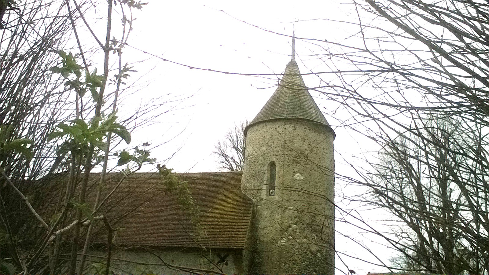
The following day was dull again as we left Lewes, and by now quite a sharp wind was blowing – into our faces too, unfortunately. But we had a pretty decent day and passed this church in Southease, one of only two (I think) in England with a round tower outside of Norfolk. The other is in nearby Lewes.
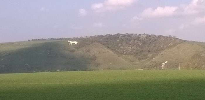
The final day began sunny but again with a sharp and unkind wind. We left Alfriston with its church on the edge of the village by the river and headed towards the coast. On the South Downs away to our right we passed a white horse carved into the chalk.
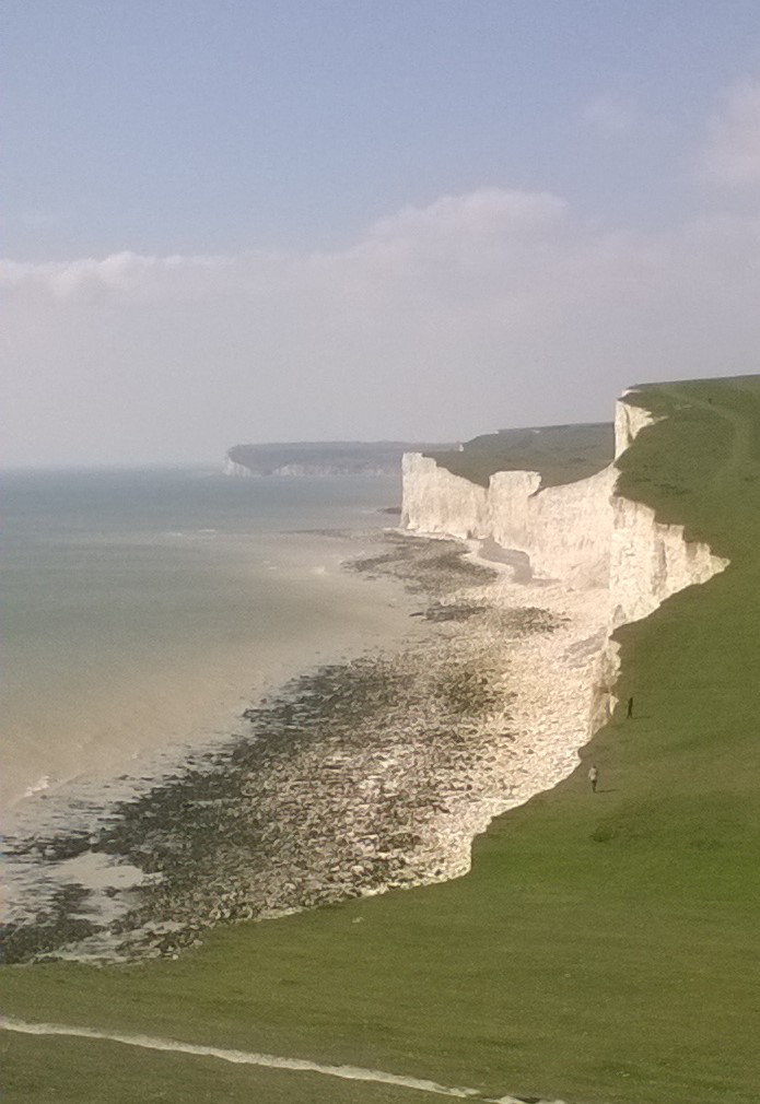
Soon we were up onto the Downs again, for the final walk into Eastbourne over the Seven Sisters and Beachy Head. I tend to forget how tiring this leg can be, going continually uphill then downhill for the best part of six miles. For some reason, although we could see the Belle Tout lighthouse in the distance, it never seemed to get any nearer. Once I could do this leg of the walk easily, but…getting a little older…
An always fantastic view, though. Here we’re looking back across the Seven Sisters towards Seaford Head.
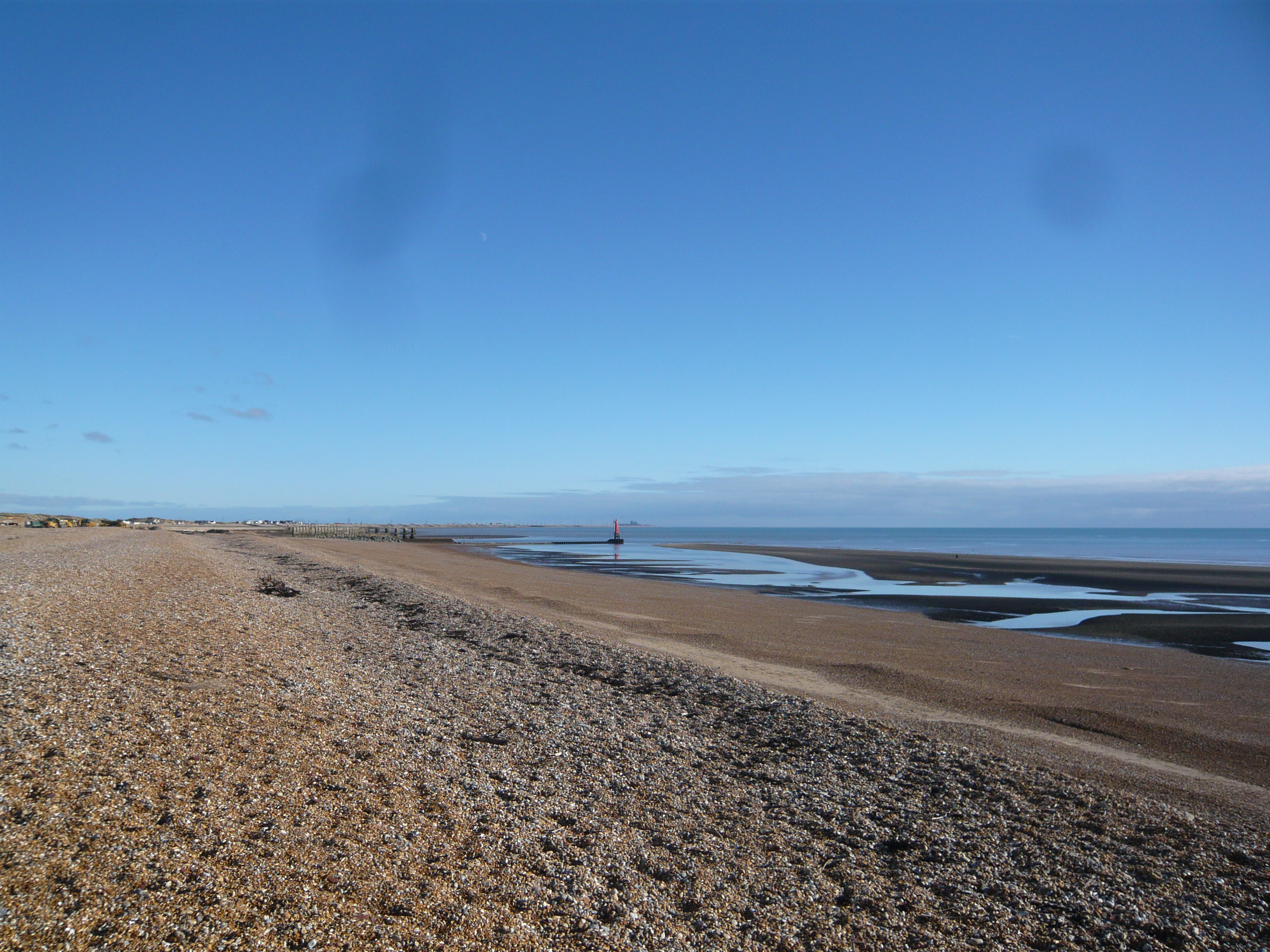
We went down to Rye harbour in Sussex, a few weeks ago, on a beautifully sunny but bitingly cold day. The actual harbour entrance is in the middle distance of the above photo with Dungeness Power Station just visible on the horizon in the distance.
This red-roofed hut sits on the shingle on the approach to the harbour and has become the iconic image that everyone photographs. I resisted the temptation this time, but took this one a few years ago. No one seems certain when it was built, but it was certainly in use from the early 1900’s onwards and was used to store fishing equipment.
The salt marshes behind the harbour constitute a nature reserve and are an important place especially for migrating birds. We walked around the marshes for an hour or so and did see quite a few birds, especially when we spent some while in a hide with the binoculars we’d brought. No close-up photos, because we were too far from the birds and I only had my pocket camera that day, but especially noticeable was was a group of some forty to fifty cormorants.
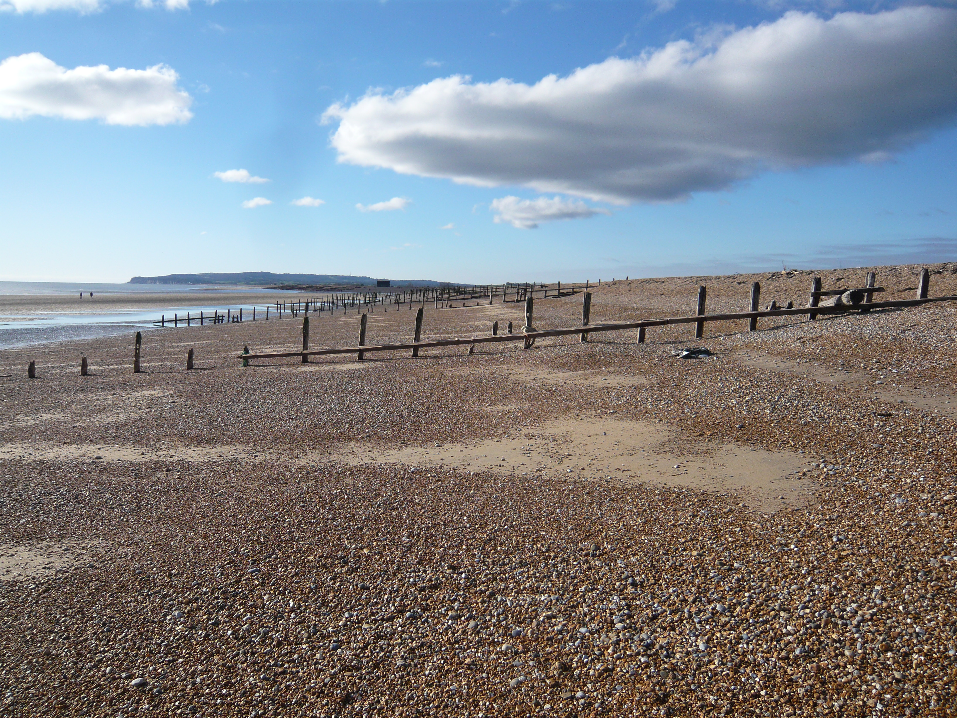
One of the tasks of the Environment Agency here is to continually move shingle in trucks westwards along the coast to shore up (pun intended) the sea defences. Due to the prevailing winds, longshore drift continually moves shingle eastwards along the coast and without this intervention it would choke the harbour mouth and undermine the sea wall at Pett (to the west). They load up the trucks with shingle from the shore, the trucks drive west and tip it out on the shore. The sea washes it eastwards along the coast again. The trucks load up with shingle from the shore…It almost feels a pointless exercise, but I suppose there’s no real alternative.
But longshore drift means that the shorelark on the South coast of England has a chance of finding rocks and stones (and all sorts of other things) that originated further to the west, and we spent some while searching among the stones here to see what we might turn up.
Shorelarking? It’s like mudlarking, but on the seashore. ‘Larking’ in this sense means looking for…well, anything. Coins, interesting rocks, anything lost or old or, preferably, both. Not that we found much, not that we ever find much, but we don’t do it as seriously as some folk. And as nice as it would be to turn up the sort of finds some people find in the mud of the Thames, we’re not that dedicated. But in the past I have found bits of flint tool while fieldlarking, and usually come home from a walk with an interesting stone or two.
We did find a couple of interesting things that day – they don’t look much, do they? But the grey stone in the centre is possibly a Mesolithic hammer stone, used for shaping flint tools while the nail had a tiny piece of wood still attached, but this crumbled away as soon as I picked it up. How old is it? I’ve no idea. Nails like that were in use from the 1800’s through into the 1900’s but it’s impossible to pin it down further. My immediate thought was it could be part of the beach groyne, but when I looked they seem to be constructed entirely with rivets. Maybe it is from an old shipwreck. The rock at the bottom is simply a lump of sandstone from further west along the coast, a piece of what was called Hastings Sandstone when I studied geology, but now known as the Ashdown beds. Nothing special, again.
Just an interesting few finds on the beach on a cold sunny day before we headed off for a warm drink.
I’ve been feeling a bit flat recently, although that’s not uncommon at this time of the year.
I know I’m currently craving solitude and simplicity, wanting to spend some time somewhere a little remote. An area of moorland, such as Dartmoor or the Pennines, would do me very nicely. Even better if there were some woodlands nearby, too. Although there would be no people around (ideally), there would be wildlife to watch and hills and valleys and those woods to explore. Maybe some interesting ruins nearby…
Simplicity, that’s what I’d want. Somewhere with no wifi, no TV, no phone signal or even radio. A decent supply of food and a few beers because, as Jerome K Jerome said, thirst is a dangerous thing. A fire to sit beside in the evening. Somewhere small and basic with no luxuries.
I’d take some books. Several sorts, so I could pick one up or swap to another depending upon my mood. At least one book of poetry, perhaps Stranger in the Mask of a Deer which I read for the first time a few months ago, and then re-read recently because it was so damned good. Maybe a Seamus Heaney collection, including the ‘Station Island’ sequence of poems, or a collection by Russian poet Yevgeny Yevtushenko for the marvellous long poem Zima Junction. Maybe I’d just take all of those.
I’d include some sort of detective novel for pure escapism, then one or two books by the likes of Robert Macfarlane – books that would inform me about the landscape I had decided to inhabit for a while.
I wouldn’t just be walking and exploring, or reading. I have a few poems I need to finish off, one about salmon and one about the Winter Solstice. In this environment I think I’d be inspired to finish them, hopefully write some more.