Bodhgaya (2) – A Special Place

About six months ago, I put up a post on Bodhgaya (which you can find here if you wish to read it again), and promised I would find a few more photos to post another time.

This is another time.

img_0018

My first picture is of the entrance to the Mahabodhi Temple, which is built on the site where the Buddha achieved enlightenment. The first temple was built by Emperor Ashoka, in the third century BC, and the present one was erected in the fifth or sixth century AD. Visitors remove their shoes (or face a one hundred rupee fine) and descend the steps from the garden that surrounds the temple.

img_0020

Just before reaching the entrance itself, they will pass this small chorten – one of dozens surrounding the temple – garlanded with marigolds.

img_0019

Many more chortens surround the temple and can be found around the gardens themselves, these ones beside a carved sandstone balustrade.

img_0024

But the Mahabodhi Temple is by no means the only Buddhist temple in Bodhgaya. As the place where the Buddha attained enlightenment, it has naturally been the focus for many Buddhists from around the world, and there are many other temples built by those from the various different branches of Buddhism. This one is one of two Tibetan temples.

img_0017

On the edge of Bodhgaya, this twenty five metre tall statue of the Buddha was erected in the grounds of the Japanese Daijokyo temple in 1989.

But Bodhgaya, naturally, is more than simply its temples. Although it is quite naturally a major tourist attraction, it is also home to many people, and daily life is not much different from other towns in Northern India.

img_0023

As you approach the temple areas from the northern side of the town, this is a fairly typical scene. In the distance, the share auto that plies between Bodhgaya and Gaya is filling up with passengers, and men and women shop for essentials.

img_0021

A woman carries a basket of dried cattle dung, which will be used to fuel the cooking fire.

img_0022

And on the edge of the town, the scene quickly becomes rural once again.

From Thursday I shall be away for a few days, but will catch up with comments and other blog posts once I am back.

A random bit of Delhi for the weekend

‘Once I leave, I am back out in noisy, smelly, confusing, squalid, hassling, bright Paharganj. When I first came here, it seemed very strange and exotic, had an unusual, exciting feel to it that was difficult to identify but was certainly the strange, unfamiliar sounds, smells, sights and feel of an unknown culture. Even the bits that were new, still seemed dirty and somehow old, as if something about them owed their existence to the distant, Indian past. This has gone and I miss it most keenly, since I keep getting a hint of it, floating unexpectedly on the breeze with sounds and smells that remind me of when I first came out here. This has been replaced, however, by something almost as precious…I feel completely at home.’ 13th November 2009
006 (2).JPG


Crowds near the Ajmeri Gate, Old Delhi

010.JPG

Turkman gate, Old Delhi. One of the gates in the city walls at the time of the Indian Mutiny / 1st Indian War of Independence, it dates from the seventh city of Delhi, Shahjehanabad. More recently, in 1976, during the Emergency declared by Indira Gandhi’s government, it was the scene of another infamous episode, when crowds protesting about the bulldozing of their houses in an effort to clear slum areas and force them out of the city were fired upon by the police, killing several of them.

011a

Tenements near the Turkman Gate, Old Delhi


IMG_0023.jpg

Mihrab, or Arch, in a building in the Lodi Gardens, Delhi

delhi_gate

Delhi Gate, in the old city near Chandni Chowk. This photo was taken in 1989. When I passed the same gate in 2009, the traffic was a whole lot worse!

191.JPG

The great tower of Qutb Minar. The first of the Moslem invasions was by Muhammed, Sultan of Ghur in what is now Afghanistan, in 1192. Having overrun a large part of the Northern Indian plains, he returned to Ghur, leaving his new territory in the hands of his army commander and favourite slave, Qutbuddin Aibak. Qutbuddin decided to leave a monument to his religion that was designed to overawe his new subjects and inspire his own people, and set about building a mosque with a massive tower nearby. The tower itself is almost 73m high and is 15m in diameter at the base, tapering to 2.5m at the top.

183

Decorative details of the stonework. Most artistic decoration is, as usual with Islamic craftwork, patterned work and verses from the Koran. At Qutb Minar, there are also plentiful stylised, and sometimes surprisingly realistic, depictions of plants with flowers and buds and long, winding stems and tendrils. To construct the mosque, artisans used stone from Hindu and Jain temples and many stones and panels still depict the original carvings, frequently defaced but still recognisable.

178.JPG

The famous ‘non-rusting’ iron pillar. This stands in the courtyard of the mosque and was here long before the mosque was built. It was made in the reign of Chandragupta II (AD 375-413), is composed of almost pure iron (99.72%) and shows only the slightest sign of rusting. A sanskrit inscription on the pillar indicates that it probably stood originally outside a Vishnu temple, possibly in Bihar, and was moved later to this site. It would probably have had a garuda, the vehicle of Vishna, on the top. 

207.JPG

Squinch-arch in Iltutmish’s Tomb. A squinch is a ‘bridging’ structure, used here to support a dome (now gone). Iltutmish was Shamsuddin Iltutmish (ruled 1211-1236), 3rd ruler of Delhi (after Qutbuddin and Aram).

175a

Brahminical motifs on the columns of the Quwwat-ul-Islam Mosque. These pillars were originally part of the Hindu and Jain temples that were razed in the area when Qutbuddin built his capital. It is chronicalled that 27 temples were destroyed. They would have been reassembled by Hindu craftsmen, Qutbuddin using local labour.


Varanasi and Sarnath

The city of Varanasi is probably the most important place in India to Hindus, whilst the ruins of Sarnath, some 10km away, mark the remains of a site of great importance to Buddhists. I stayed there for three days, some 8 years ago.
039
Dasaswamedh Ghat, Varanasi. Taken from the top of the steps (ghats). The River Ganges is the holiest river to Hindus, and Varanasi is the one of the holiest cities. Previously named Benares (and often so still called) and Kashi (City of Life), it is visited by Hindus in their millions who come to bathe in the Ganges to purify their souls. In a final journey, many are cremated here and their ashes cast into the river, believing that this will help to achieve liberation from rebirth.

040

The river Ganges from Dasaswamedh Ghat, Varanasi.

038

Stalls on the ghats at Varanasi. Varanasi never seems less than vibrant and colourful.

055

And another stall near the ghats.

049

Down at the ghats I was trailed by this cheerful young rogue demanding money to have his photo taken or to show me the sights or sell me souvenirs or lead me to stalls where I could purchase to my heart’s content or…whatever.

037

Street scene in Varanasi. The church in the middle distance is Saint Thomas’. This was taken quite early in the morning when I was on my way to the ghats. Early afternoon as I was returning, it was packed solid, traffic completely unable to move.

004

10km outside Varanasi lie the ruins of Sarnath. After the Buddha had achieved enlightenment at Bodhgaya, he came to Sarnarth – a walk of some 250kms or so, through what would have been highly dangerous country then – to seek out his former companions and in the Deer Park there he gave his first sermon, on the turning of the wheel of law. This comprises the Buddha’s path to Enlightenment: the Four Noble Truths, the Eightfold path and the Middle Way. In the 3rd century BC, the emperor Ashoka, a convert to Buddhism after witnessing the terrible carnage of a war he had unleashed, built stupas and monasteries here as well as an engraved pillar. These survived until the end of the 12th century when they were destroyed during the Muslim invasions and not rediscovered until 1834 by a British archaeological team.

008


This altar stone in the ruins of Sarnath) is still being used by pilgrims for pujas.

013.JPG

Dhamekh Stupa at Sarnath . This solid cylindrical tower, 33m in height, supposedly marks the place where the Buddha gave his first sermon. The base is stone, covered in delicate carvings, and the upper part brick.

016.JPG

Carvings adorning the base of the Dhamekh Stupa.

Libya – Leptis Magna

Libya certainly seems to have suffered more than its fair share of misfortune over the years.

I was there in 1988 for six months – not that I’m suggesting that was one of their misfortunes – which should have been a good opportunity to get to know one of those countries that chose to be rather secretive and closed off to the outside world. It didn’t work out that way, of course.

As Westerners, we found it very hard to penetrate Libyan society and, to be honest, we really didn’t try that hard. There were almost no opportunities for socialising with local people, we were regarded with great suspicion by the authorities (although so were most of the general population, of course), and so we ended up in our enclaves even more than is usual in most ex-patriot societies.

But despite that, I discovered that the majority of the Libyans I did meet were wonderful, warm-hearted people. A few were slimeballs, but the same goes for the Westerners – many were great folk, but a few of them were also slimeballs, including the so-called friend who amused himself one evening by spiking my drinks with near-neat alcohol, knowing I was driving home afterwards. If by any freak of chance you ever read this, Shaun, you really are a shit.

It was always said that, as unpleasant and bad as Gaddafi undoubtedly was, there were others around him who were even more seriously dangerous and unhinged. Unfortunately, it seems that a number of them and their colleagues are still wreaking havoc in the country, along with the twisted followers of Isis and various other militias.

But the purpose of this post is to put up some photos that I took in Leptis Magna, which was a huge Roman city a couple of thousand years ago, and is located on the Mediterranean coast near the town of al Khums, some 125 km east of Tripoli. It is the largest extant Roman city outside of Turkey, and is a Unesco designated World Heritage site. I had visited Rome in the past, and I was astonished to see the extent of the remains at this site, which easily dwarfed those in the Roman capital.

Libya was certainly a place where I generally felt uncomfortable taking photos, and so I took very few other than these ones. The quality of the photographs, though, are generally very poor, I’m afraid, since all I took with me was an incredibly cheap camera. I was warned that there was a good chance that anything you took into Libya might get confiscated or simply stolen. The prints have also faded badly over time, and so these are presented purely for general interest.

I do have some more photos of Leptis Magna somewhere, which might be in better condition, so I will try to hunt them out for another time.

Leptis Magna is another one of those ancient sites that is under threat of destruction by the fanatics of Isis, and although I have followed quite a few threads on the internet, I am unable to find out whether there has been any actual destruction there yet. What I do know is that a group of very brave Libyans have formed a kind of militia to protect the ruins. I can only hope that they, and the ruins, are all well.

IMG_0004

Roman  Amphitheatre

IMG_0001

Roman basilica – converted to a church in the fourth century AD

IMG

Roman baths

IMG_0002

Along a Roman street…

IMG_0003

Through doorways and buildings…

IMG_0005

…and along another Roman street.

Bodhgaya (1)

I spent a total of 2 months in Bodhgaya, Bihar, but I seemed to end up with surprisingly few photographs of the town and surrounding countryside. Here are a selection of them, though, and I may put a few more up sometime soon. Hence the somewhat tentative ‘part one’ in the title.

mahabodhi temple


 Bodhgaya is a world heritage site, because the Mahabodhi Temple was built at the site where the Buddha is supposed to have achieved enlightenment, some 2500 years ago. The original temple was built by the emperor Ashoka in the 3rd century BC. The current temple dates from the 11th century AD, and was restored in 1882 by the Burmese. Surrounded by the usual frenetic Northern Indian crowds, and visited by a huge number of pilgrims and visitors, the temple and grounds still manage to somehow achieve an unbelievably peaceful ambience.


IMG_0002

The Bhodi tree at the Mahabodhi Temple. It is a third generation descendant of the tree under which the Buddha is supposed to have achieved enlightenment.


img_0025

Thai temple, Bodhgaya. As well as the Mahabodhi Temple, Bodhgaya also has temples built by virtually every country with a sizeable Buddhist population. As befits the place where the Buddha originally achieved enlightenment, it is an active Buddhist centre with many charitable projects set up and running.


dawn-panorama
Dawn over Sujata Village, Bodhgaya. This was often the view that greeted me when I walked across the dry bed of the River Phalgu from Bodhgaya to the village of Sujata, in the cool of the morning. A rich reward for getting up early!


hindu-temples-panorama

Hindu temples on the edge of Sujata Village.

IMG

Fields in Sujata Village. In the vast majority of Indian villages, fields are still worked by hand or with animal labour. here is no exception.

IMG_0016.jpg

Farms at the edge of Bodhgaya. Although Bihar is the most corrupt, poverty-ridden state in India, sitting at the bottom of the table in almost any set of statistics that you may care to consult, the land appears lush and fertile, supporting a strong agriculture.

img_0026

And whilst we’re on a rural theme…a street corner in Bodhgaya.


IMG_0012.jpg

Monks heading for morning puja (ceremony) in Sujata.

temple door bodhgaya.jpg

Temple door in Bodhgaya.

img_0027

Dawn in Bodhgaya. The moslems are heading for the mosque, whilst most of the others are heading for work, for puja at Hindu or Buddhist temples, or to find breakfast.

I was after breakfast.

Himalayan Foothills

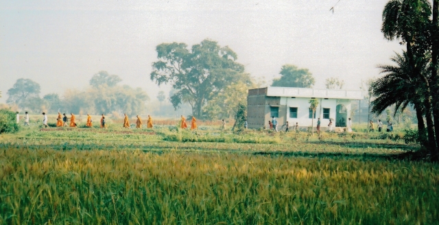
I am going offline for a few days, since I need a bit of a break, so I will leave you with a selection of photographs from the Himalayan Foothills, Northern India. When I log on again in a few days, I’ll catch up with everyone’s blogs and comments.

By ‘Foothills’ I mean the ranges of hills and smaller mountains that guard the approach to the Himalaya proper, where the big beasties rise up to heights of over 8000m with permanent ice and snow cover. The old Raj hill stations such as Nainital and Darjeeling were built at heights of around 2000m – high by UK standards, but certainly not by Himalayan ones.

one

Naini Tal, Nainital Town, Northern India. Morning Light. Nainital lake, (‘naina’ is Sanskrit for eye and ‘tal’ means lake) in Hindu mythology, is one of the emerald green eyes of Sati, Shiva’s wife. This was my first view of it after getting off of the overnight bus from Delhi.

two

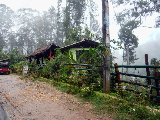
Gadhar Kunkyop Ling Gompa, Nainital. Unlike many other Himalayan towns, Nainital has no sizeable Tibetan population, and this Monastery, perched high to the North East, overlooking the lake, is the only one in Nainital and home to just seven monks.

three

Morning mist, Nainital.

four

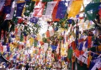
A sea of prayer flags on Observatory Hill, Darjeeling. Darjeeling, unlike Nainital, has a large Tibetan population and many Gompas both in the town and the surrounding hills. Observatory Hill is the site of the original temple of Dorje Ling, long destroyed, but after which the town was named, once the British had persuaded the then ruler of the area, the Chogyal of Sikkim, to lease them the land to build a hill station. The hill is now home to a Hindu shrine, with the British built church of Saint Andrew close-by.

But no Gompa.

five

The ‘Toy Train’ stopped outside Samten Choling Gompa at Ghoom, near Darjeeling. This train runs for 51 miles from Siliguri to Darjeeling, rising a total of just over 7000 ft. It has numerous steep gradients and sharp curves, including the famous one at ‘Agony Point’ – originally the loop there was a diameter of only 59.5 ft and the train literally overhung the mountainside as it rounded the curve. All in all, quite a remarkable engineering feat and deservedly a World Heritage site.

six

Druk Sangak Gompa, a large Buddhist monastery on the edge of Darjeeling, West Bengal. A fairly new gompa, it was inaugurated by the Dalai Lama in 1992.

seven

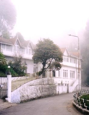
Not Chelmsford, UK, but Darjeeling, West Bengal). Many of the old British hill stations, such as Darjeeling, still retain much of their colonial character.

eight

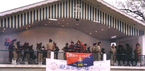
A clash of cultures! And what a clash. East meets west, with brass band in the park meeting the Indian Himalaya, courtesy of the Darjeeling Police Band. The band played in a bandstand on the Chowrasta, the open square at the top of Darjeeling, close to Observatory Hill. In the days of the Raj, this would, no doubt, have been familiar to all who lived there. Close your eyes and think of England…

nine

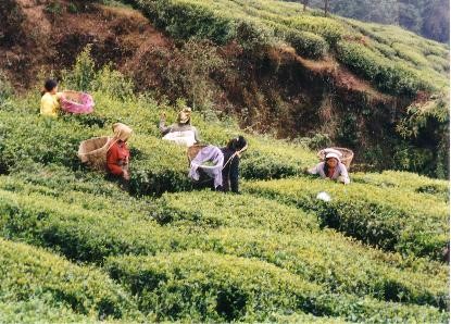
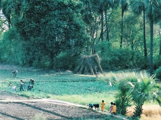
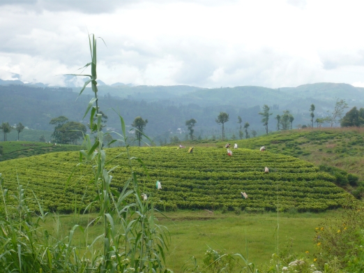
Tea pickers, Darjeeling. Think of Darjeeling, think of tea. In the hills surrounding Darjeeling are numerous tea estates, where the job of tea picking, sorting, drying and packing goes on much as it has done for the last 150 years.

ten

Buddhist painting on rock wall, by open air shrine, Darjeeling. As well as the larger gompas, you come across small shrines and gompas unexpectedly around odd corners everywhere.

eleven

Prayer Lags in Yumthang Valley, Northern Sikkim. This is as far north in Sikkim that you are allowed to travel, just a few miles south and west of Tibet. Everybody is still very touchy about borders.

twelve

Crossing a bridge in the Yumthang valley. It should be safe, considering the number of prayer flags!

thirteen

Unnamed 6000m peaks overlooking the Yumthang Valley. We asked our guide the names of these peaks, only to be disparagingly told ‘They don’t have names. They’re less than 6000m tall.

fourteen

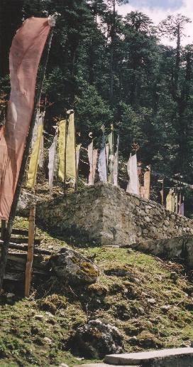
And more prayer flags…

fifteen

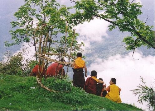
Young monks on a hillside, Phodong Gompa, Sikkim.

sixteen

Monastery wall painting, Lachung Gompa, Northern Sikkim. Lachung Gompa is about 2km above Lachung village, at a height of about 3000m. It is not a ‘working’ gompa, the monks living down in the village rather than at the gompa, so it is generally kept locked and only used on festivals and full moon days.

seventeen

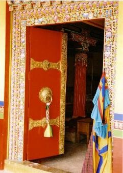
Monastery door, Tharpa Choling Gompa, Kalimpong, W.B. Kalimpong, not far from Darjeeling, but 1000 metres lower, has also a large Tibetan population.

eighteen

Statue of Chenrezig (Avalokiteshvara), Durpin Gompa, Kalimpong, West Bengal. Chenrezig (Tibetan) or Avalokiteshvara is the Bodhisattva (a being who has partly or completely attained the state of enlightenment) of compassion. The well-known mantra ‘Om Mani Padme Hum’ is dedicated to him.
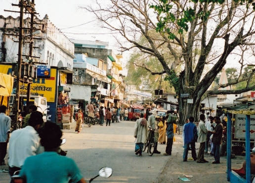
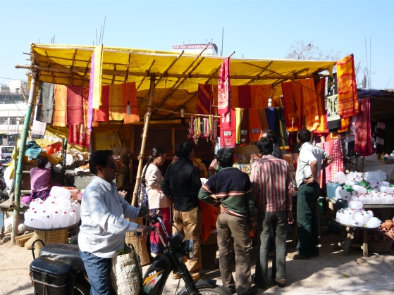
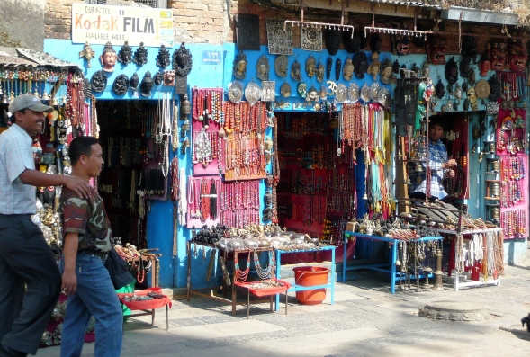
Kalimpong market:

nineteen

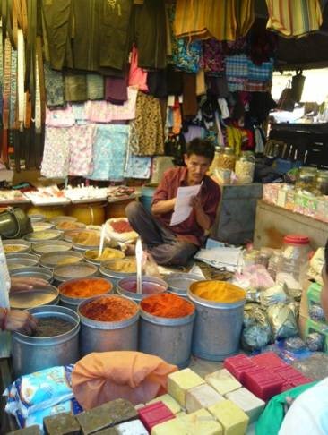
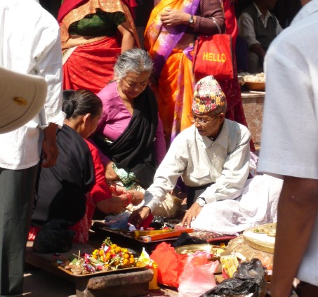
I watched this gentleman for some time before I approached and asked for a photo. he was rapidly serving a succession of customers at great speed, making up little paper screws of spices and powders at a tremendous rate…

twenty

…whereas this gentleman served his customers at a more leisurely pace, as if he had all the time in the world.

twenty one

This gentleman was delighted to be photographed with his fine collection of Kukris. As I prepared to take the photo, he picked up a kukri and brandished it with a none too convincing snarl, to the obvious amusement of most of the people around him.

twenty two

This stall-holder seemed to find it hilarious that I should want to photograph her.

twenty three

This lady, on the other hand, was delighted to be photographed; volunteering eagerly when a lady on a nearby stall refused.

twenty four

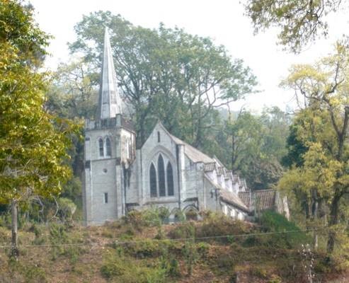
The Katherine Graham Memorial Chapel, in the grounds of the Dr Graham School and home, Kalimpong. Built in 1925, it looks to have materialised straight out of the Scottish Highlands. Dr Graham was a Scottish missionary, and built the home and school originally to educate the children of local tea estate workers. It now has a far broader intake.

twenty five

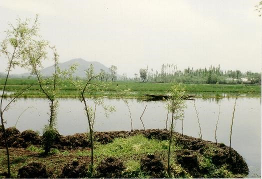
Lake Dal, Srinagar, Kashmir. Unfortunately, it is still probably unwise to visit most of Kashmir, and things will probably remain this way for some considerable time to come. A pity, because this really is a most beautiful part of India and Pakistan. I took these photos in 1989, a very short while before the area became off-limits to tourists.

twenty six

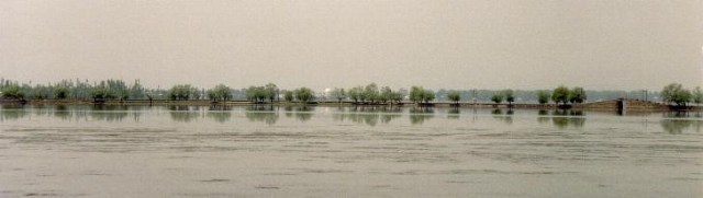
Panorama – Lake Dal, Srinagar, Kashmir). In the distance is the Hazratbal Mosque, a comparatively modern mosque, enshrining a hair of the prophet.

twenty seven

Hindu shrine. Near the shore of Lake Dal in Kashmir.

twenty eight

Houseboats around the shore of Lake Dal, Shrinagar, Kashmir. In the nineteenth century, the British, who first developed Srinagar as a hill station to get away from the stifling heat of the Indian Plains in the summer, found that the then Maharajah refused to sell them land to build houses. The solution? They built boats to live on…great, elaborate, ornate carved and decorated houseboats. These same boats, with many more recent editions, now function as floating hotels to tourists. The majority are moored not on the actual shore, but a little way off, often on the edge of small islands. This gives the local shakira (a type of small boat unique to Lake Dal) owners a chance to clean up, as a taxi service.

twenty nine

Shakira moored on Lake Dal.

Kathmandu, Nepal

How on earth have I managed to blog for almost a year, now, and still not put up a single post on Nepal? I think I’d better put that right immediately.
I’m going to start with a selection of pictures from Kathmandu, capital of Nepal.
All of these pictures were taken before the dreadful earthquakes of last year, and I do know that some of the buildings in these pictures (especially in Durbar Square) were sadly destroyed.

015a.jpg

The entrance to Swayambunath. Swayambunath is the main Tibetan Buddhist site of Kathmandu. Sitting on top of a hill overlooking Kathmandu, it comprises temples, stupas and various other buildings, including a couple of Hindu shrines. Here, a Hindu holy man lurks in ambush, ready to dab a tikka mark on the forehead of (especially) western tourists and demand rupees for the privilege.


038.JPG

The sacred and the secular at Swayambunath. In Nepal, as in India, it is almost impossible to visit a religious site without Mammon getting a good look in. Here, in the main Buddhist site of Kathmandu, everything from yak bells to masks.


034a
‘One day, my boy, all this will be yours’ – just as long as you have enough money and all the time in the world to bargain hard. More shops – seriously colourful, seriously prepared to sell you anything. And having said that, the hard sell is a world removed from India. It almost feels as though there is no pressure at all. In Nepal, you feel you can relax again, especially if you have just travelled there from India.
056.JPG

Nuns lighting butter lamps beneath a row of prayer wheels at Swayambunath.

030a

Hindu puja at Swayambunath. Probably a private ceremony at the request of the beneficiary, either for good luck in general or with a particular goal in mind (e.g. birth of a son, successful business venture.)


031b
Portrait of a Hindu lady.
057

Tourist shop in the Swayambunath complex.
100

Buildings in Durbar Square. Durbar (or ‘Palace’) Square is the heart of the old town and the area where the Kings used to live in the 18th and 19th centuries. In contrast to Swayambunath, this area is entirely Hindu, reflecting the vast majority of the lowland Nepali population.

102a

Side street in Thamel, Kathmandu. The lovely old buildings…beautiful wood carvings…collapsing brickwork…wiring all over the place…speed…calm…old and new…………the only things I can’t bring you are the sounds and smells…you must imagine them for yourselves. Coming soon, scratch and sniff websites!!!


098

Bicycle rickshaws awaiting customers in Durbar Square.


067b

Balloon seller and hopeful customer, Durbar Square.


070

Kala Bhairab – an image of Shiva in his most fearsome aspect. Wearing a garland of skulls, the six armed Kala Bhairab tramples a corpse, symbolic of ignorance. Carved originally from a single stone, it was set up by Pratap Malla, king in the 17th century. He was a pious Hindu, but interested in the arts and tolerant of other religions. He even restored much of Buddhist Swayambunath. It is said that telling a lie while standing before Kala Bhariab will bring instant death. It was once used as a form of trial by ordeal.


img
Pashupatinath, on the Eastern side of Kathmandu, is the holiest of the Hindu sites in the city. It is the temple of Shiva, on the Bagmati river and hence it includes the ghats, the most widely used place of cremation for Hindus in Kathmandu, indeed, in Nepal.

Sri Lanka – The Hill Country

I thought I’d bring you a third helping of Sri Lanka today, so to speak. These are a few of the photographs that we took when we went up into the hill country for a few days.

179

First up, a view of Ella Rock taken across the tea gardens.

177

Next, a view of the charming Lizzie Villa, our home for a few days. It is set in beautiful gardens, and run by our equally charming hostess, Mrs Lizzie. For the first day or so, we had good weather – rather humid and a little cloudy, but pleasant enough. But then the heavy rain arrived, and our walk from the road to the villa became an adventure in trying to avoid the leeches that magically appeared from every leaf and twig.

181

During one of the breaks in the weather, we walked to Little Adam’s Peak which is approximately an hour and a half’s walk from Ella to the top. On the way back, we stopped in this lovely flower-covered cafe for some late refreshments.

167

Tamil tea pickers in a tea garden near Nuwara Eliya. Most tea pickers in Sri lanka are still Tamils, descendants of those brought from India by the British over a hundred years ago to work in the tea gardens.

170

A farmstead in the jungle near Haputale.

172

Hillside jungle near Ella.

184

Finally, the rather quaint railway station at Ella, which was unfortunately closed due to landslips on the line when we wanted to get the train back down to Kandy. We had left the cottage early, and a taxi had dropped us off here. But when it was apparent that the line was closed, the taxi driver very kindly loaded us back into his taxi, drove us to a bus stop and explained which bus we should get, where we should go, and what bus to take from there to Kandy. And would he let us pay him? No, he wouldn’t. Small, unexpected, kindnesses again.

Sri Lanka (2)

Sra Lanka – Ancient Cities

Today, a return to Sri Lanka, and a few of the photographs that I took at some of the ancient sites.

Dambula – Rock Temple – reclining Buddha. There are 5 caves in all, each one more splendid than the last (assuming, of course, that you visit them in the correct order!), containing some 150 Buddha images.

SRPanorama 1thumb

SR250athumb

Dambula – Rock Temple -feet of reclining Buddha statue.

BELOW: A further selection of images from the caves at Dambulla.

SR247thumb

SR241thumb

SR238athumb

SR227thumb

SR243thumb

SR283thumb

Anuradhapura – Red brick Jetavanarama Dagoba.

SR261thumb

Anuradhapura – moonstone. Moonstones were not merely designed to be decorative, the patterns and figures are all relevant to Buddhist cosmic symbology.

SR288thumb

Anuradhapura. The Ruvanvelisaya Dagoba.

SR289athumb
Anuradhapura. Elephant carvings at the Ruvanvelisaya Dagoba.

SR265athumb
Buffaloes at Anuradhapura doing what they do best!

Kandy and Environs

A few pictures from Sri Lanka, today. I have only had the pleasure of one visit there so far, but it is another place that I should like an opportunity of returning to at some point. These ones are all from the time that we spent around Kandy, Sri Lanka’s second city up in the hills of the Central Province, and which enjoys a much cooler climate than that down in Colombo.

106a

On the bus to Lankatilake. Like most of the rest of the Indian subcontinent, the cabs and interiors of buses, taxis and lorries in Sri Lanka tend to be dedicated to placating whichever deities preside over traffic accidents and mishaps. The majority in Sri lanka, like this one, are Buddhist.

082

Lankatilake Buddhist temple, some 10km SW of Kandy. The temple also has a Hindu shrine incorporated in it.

094

Inside the Buddhist shrine.

093

Bodhi tree at Lankatilake temple. Bodhi trees are to be found at all Buddhist temples, and are all descendants of the tree that the Buddha achieved enlightenment beneath, 2500 years ago at Bodhgaya, Northern India. Properly, they are Sal or Neem trees. Only the ones descended from the original Bodhi tree are called Bodhi trees.

098

Lotus flower in the tank at Lankatilake. As in India, ‘tank’ refers to any artificially created body of water, from temple pools all the way up to reservoirs.This tank is a small, circular construction, and can be seen on the left in the photo of Lankatilake above. With its roots in the mud, its stem growing through the water and its beautiful flower in the air, The lotus has special significance to Buddhists – it represents the true nature of beings, who rise through samsara (the suffering of this world) into the beauty and clarity of enlightenment.

096

Hindu temple entrance at Lankatilake.

095

Dagoba at Lankatilake. ‘Dagoba’ is the name used in Sri Lanka for the structures known elsewhere as pagodas. They are usually built around a holy relic of some sort.

063

Here in this shop in Kandy, you can get postcards and masks, false teeth and gramophone needles, shoes and Buddhas, elephants and exhortations to love Jesus. Something for everyone, really.

200a

The Departure Board at Kandy station. We were waiting for the 3pm train to Colombo, departing from platform 3.


119

Beautifully carved and painted ceilings in the Temple of the Tooth, Kandy.

123

Entrance to the shrine room, Temple of the Tooth.

134

Moonstone, Temple of the Tooth. A moonstone is a richly carved stone, frequently placed at the bottom of a flight of steps. It is semi-circular in shape.

127

Door, Temple of the Tooth.