The Travel Bug Bit Me – part 2

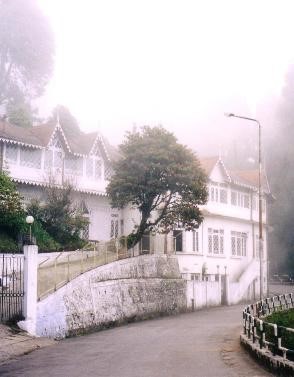
There never seems to be a better time to set off on a journey, especially a walk, than first thing on an early autumn’s morning. It is late enough in the year to have a proper sparkling dew, usually covering cobwebs draped across bushes, and ideally there will be some bright sunshine, a hint of sharpness and the colours of leaves beginning to turn, berries in the hedgerows, and still an abundance of flowers. This is another hark back to my teenage years, I’m sure. It all seemed quite magical then, and it still does today.

023

I suppose, at the time, it could be said that I had a head full of hobbits. Of my contemporaries at the time, those with itchy feet tended to be either those who read and re-read Kerouac’s ‘On the Road’, and those who did the same with ‘The Lord of the Rings’. I fell squarely into the second camp, never really discovering the appeal of Kerouac. I guess they were largely the crowd who enjoyed ‘Easy Rider’ and wanted to travel Route 66. Later, I read Laurie Lee’s ‘As I walked out one midsummer’s morning’ and found the same atmosphere there. I walked from the London suburbs, where I lived at the time, with a friend down to Hastings. On the way we stopped at a couple of youth hostels, and had a couple of nights wild camping in woods. And everything did seem magical, although apart from the distance in time, I do not know why this should have been. All of the fields and woods, hills and hedgerows, seemed somehow to fill my head and assume a greater importance than anything else in my life at that time. Otherwise I would hitch hike down to the coast, or the West Country, and this would satisfy my sense of adventure, never knowing where I would end up and forever feeling as though I was travelling through an undiscovered land.

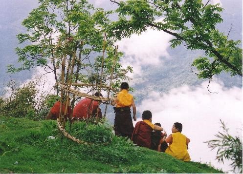
I don’t think, as a teenager, that I was ever happier than when I was off for a long walk with friends, or even on my own. I still get that same sense of pleasure when I arrive at my destination after a day’s walking, whether it be the spot that I’ve chosen for my wild camp on a mountain side somewhere, or a bunkhouse or hostel on the edge of a village where I know I can stroll to a nearby pub for a meal and a few pints in the evening. My chosen destinations then tended to be youth hostels, and I remember an awful lot of them fondly, still today. I think that my favourite, then, must have been Land’s End. I wonder how many people now remember the awesome murals that they had over most of the walls, inspired, of course, by Tolkien! The days were spent, whilst strolling through lanes and along footpaths, learning to recognise wild flowers and trees, butterflies, but not so much the birds. Even in those days my eyesight was too poor for that!

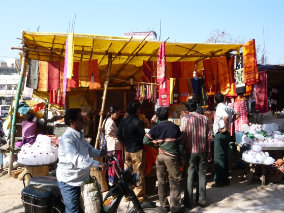
‘Rambling’ is used extensively as an insult by many of the climbing fraternity, yet it means no more than long distance walking, at a fairly relaxed rate. My dictionary defines it as walking for pleasure, with or without a definite route. This would seem a fair definition, and includes hill walking, trail walking, any type of walking, in fact. I think that the intended barb is that it is ‘soft’, yet people who would think of themselves as ramblers include very elderly people whom I have observed galloping over the fells at a rate to put roughtie-toughtie young climbers to shame. Its popularity, at least in Britain, stems from the last century when it was taken up by factory and mill workers in the north of England, in particular, as a healthy and cheap form of sport and entertainment. There is a point, in fact, where it merges into climbing, having passed through the scrambling and mountaineering stages.

Is it a coincidence that it seems that most of the best trips that I’ve read about in books have been done by solo travellers? If they have not been strictly alone, then they are using porters or guides who have been employed specifically to help the explorer along his chosen route, rather than suddenly say ‘Ooh, no. I don’t fancy that anymore. Let’s go back now.’

 Most of my own distance walking has been done in my own company. This always has the advantage that I can decide when and where I travel, when to stop for a break, when to go off on a diversion to see a particularly interesting (to me) village or hill or something. I do often miss the company of others when I walk or travel, and enjoy it when I do get it. I find it good to travel with somebody for a while, and then to move on again by myself when we begin to disagree over the route, or want to move at a different rate (or politics or religion intervenes, of course!). I suppose that this is also not entirely disconnected with my love of solitude. When hill walking, especially, I almost resent meeting other people. Especially large groups. Amongst the list of things that I positively hate coming across in any wilderness area, such as discarded lunch wrappers, people bellowing into mobile phones (‘Yes, I’m on the summit, now!’ – do some people have these damn things surgically attached to their heads?), music, for God’s sake – why would anyone want to hike out somewhere remote, where the predominant sounds are bird calls and the wind in the grass, listening to a bloody i-pod? – comes the large group of walkers.

There is no logical reason why I should, and it is certainly not due to a feeling that they have no right to be there. I just crave solitude in those situations. If I was asked to name my favourite day out walking in the hills of Britain, I think that I would unhesitatingly mention a November’s day some years ago, when I walked the Carnedd Horseshoe in North Wales. This particular circular route starts at the village of Bethesda and heads up a gently rising valley onto a ridge until it reaches the mountain of Carnedd Dafydd, where you then amble up to the summit. From there, there is a ridge walk to Carnedd Llewelyn, a shorter ridge to Yr Elen, then gently back down to Bethesda. The day was unusually warm for November, with sunshine and a beautiful clear sky throughout. And although Carnedd Dafydd is the second highest mountain in Wales, after Snowdon, it sees far less traffic of human feet than most other parts of North Wales. Consequently, I had a day’s walking in one of the most beautiful parts of the world, in fantastic weather conditions, without meeting another soul. Perfect.

img

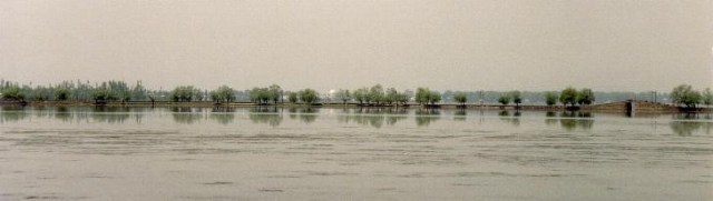
I always used to do this with photos to make up panoramas – it’s a lot easier today!

Some people, although they would prefer to travel in company, choose ‘alone’ because they become good at doing ‘alone’.

I’ve heard it said, and frequently read it, that there is nowhere left on the planet to explore, anymore. I suppose that if what is meant by that is that there are no longer maps of whole countries or continents published that have ‘unexplored’ or ‘here be dragons’ printed over large, blank areas, then, yes, that is so. But if I go anywhere that I have not been to before, especially if I have read little or nothing about it, then I am exploring. I may not be contributing anything towards the sum total of human knowledge, but I am making discoveries for myself.

Thank heaven, though, that there are still areas of the Earth that are wildly beautiful and lawless, where outsiders, especially westerners, fear to tread, and life is cheap but the landscape is breathtaking.

Varanasi and Sarnath

The city of Varanasi is probably the most important place in India to Hindus, whilst the ruins of Sarnath, some 10km away, mark the remains of a site of great importance to Buddhists. I stayed there for three days, some 8 years ago.
039
Dasaswamedh Ghat, Varanasi. Taken from the top of the steps (ghats). The River Ganges is the holiest river to Hindus, and Varanasi is the one of the holiest cities. Previously named Benares (and often so still called) and Kashi (City of Life), it is visited by Hindus in their millions who come to bathe in the Ganges to purify their souls. In a final journey, many are cremated here and their ashes cast into the river, believing that this will help to achieve liberation from rebirth.

040

The river Ganges from Dasaswamedh Ghat, Varanasi.

038

Stalls on the ghats at Varanasi. Varanasi never seems less than vibrant and colourful.

055

And another stall near the ghats.

049

Down at the ghats I was trailed by this cheerful young rogue demanding money to have his photo taken or to show me the sights or sell me souvenirs or lead me to stalls where I could purchase to my heart’s content or…whatever.

037

Street scene in Varanasi. The church in the middle distance is Saint Thomas’. This was taken quite early in the morning when I was on my way to the ghats. Early afternoon as I was returning, it was packed solid, traffic completely unable to move.

004

10km outside Varanasi lie the ruins of Sarnath. After the Buddha had achieved enlightenment at Bodhgaya, he came to Sarnarth – a walk of some 250kms or so, through what would have been highly dangerous country then – to seek out his former companions and in the Deer Park there he gave his first sermon, on the turning of the wheel of law. This comprises the Buddha’s path to Enlightenment: the Four Noble Truths, the Eightfold path and the Middle Way. In the 3rd century BC, the emperor Ashoka, a convert to Buddhism after witnessing the terrible carnage of a war he had unleashed, built stupas and monasteries here as well as an engraved pillar. These survived until the end of the 12th century when they were destroyed during the Muslim invasions and not rediscovered until 1834 by a British archaeological team.

008


This altar stone in the ruins of Sarnath) is still being used by pilgrims for pujas.

013.JPG

Dhamekh Stupa at Sarnath . This solid cylindrical tower, 33m in height, supposedly marks the place where the Buddha gave his first sermon. The base is stone, covered in delicate carvings, and the upper part brick.

016.JPG

Carvings adorning the base of the Dhamekh Stupa.

A Shared Humanity

‘The world knows nothing of its greatest men’ goes the old saying. Or women, of course, since it is men who tend to write these things. I may have alluded to this before.

017

I was reading a blog post by Rajiv earlier today, on the partition of India and Pakistan in 1947, and we swapped a couple of comments, the result of which decided me to write this short post. You can read Rajiv’s post here: Partition in the Punjab

Those of us who did not live through that time, cannot really imagine the full horror of it all. The figures alone are dreadful.

14 million people were displaced, forced to move from their homes to either what remained India or became East or West Pakistan, by any means of transport available, frequently on foot. Those that survived the journey, frequently one of tremendous hardship, carried memories that were often too dreadful to relate.

Most lost their possessions.

Families were split apart and separated, many of them never to meet again.

Millions of refugees.

Up to 1 million were killed in what were effectively religious killings – the actual figure is unknown. Trains were set on fire, men and women, adults and children, lost their lives in what became a frenzy of killing.

Much, of course, has been written of this over the years, and the blame placed on many shoulders. The British were extremely culpable in this case, mainly through neglect and thoughtlessness. Those that assumed power in India and Pakistan need to take their share of the blame, too.

But the world, as I remarked at the start of this post, knows nothing of its greatest men. Or, in this case, its greatest men and women, or at least very little of them.

On both sides of the new borders, whilst most people succumbed to fear and many to hatred, whilst innocent lives were taken and dreadful acts carried out, there were many, many people who sheltered and saved those of other religions who had been their friends and neighbours before, often at great personal risk.

They gained nothing from it, but simply displayed their common humanity.

I have read of a few examples of this, a few stories from both sides of that border, and I have seen it mentioned briefly in documentaries.

But now, before the last players in that tragedy finally pass away, it would be marvellous if there could be a concerted effort to collect these stories and record them, as an inspiring example of people reaching out to each other across what is, once again, becoming a depressingly familiar religious divide, and, most importantly, remembering and commemorating their bravery.

How India Changed an Englishman

I wrote a piece for The Good Men Project, about my time in India and how I came to write Making friends with the Crocodile’. Sushi Menon kindly edited it to make it readable, and gave it a title, and you can find it here:

How India Changed An Englishman

Making Friends with the Crocodile cover

Libya – Leptis Magna

Libya certainly seems to have suffered more than its fair share of misfortune over the years.

I was there in 1988 for six months – not that I’m suggesting that was one of their misfortunes – which should have been a good opportunity to get to know one of those countries that chose to be rather secretive and closed off to the outside world. It didn’t work out that way, of course.

As Westerners, we found it very hard to penetrate Libyan society and, to be honest, we really didn’t try that hard. There were almost no opportunities for socialising with local people, we were regarded with great suspicion by the authorities (although so were most of the general population, of course), and so we ended up in our enclaves even more than is usual in most ex-patriot societies.

But despite that, I discovered that the majority of the Libyans I did meet were wonderful, warm-hearted people. A few were slimeballs, but the same goes for the Westerners – many were great folk, but a few of them were also slimeballs, including the so-called friend who amused himself one evening by spiking my drinks with near-neat alcohol, knowing I was driving home afterwards. If by any freak of chance you ever read this, Shaun, you really are a shit.

It was always said that, as unpleasant and bad as Gaddafi undoubtedly was, there were others around him who were even more seriously dangerous and unhinged. Unfortunately, it seems that a number of them and their colleagues are still wreaking havoc in the country, along with the twisted followers of Isis and various other militias.

But the purpose of this post is to put up some photos that I took in Leptis Magna, which was a huge Roman city a couple of thousand years ago, and is located on the Mediterranean coast near the town of al Khums, some 125 km east of Tripoli. It is the largest extant Roman city outside of Turkey, and is a Unesco designated World Heritage site. I had visited Rome in the past, and I was astonished to see the extent of the remains at this site, which easily dwarfed those in the Roman capital.

Libya was certainly a place where I generally felt uncomfortable taking photos, and so I took very few other than these ones. The quality of the photographs, though, are generally very poor, I’m afraid, since all I took with me was an incredibly cheap camera. I was warned that there was a good chance that anything you took into Libya might get confiscated or simply stolen. The prints have also faded badly over time, and so these are presented purely for general interest.

I do have some more photos of Leptis Magna somewhere, which might be in better condition, so I will try to hunt them out for another time.

Leptis Magna is another one of those ancient sites that is under threat of destruction by the fanatics of Isis, and although I have followed quite a few threads on the internet, I am unable to find out whether there has been any actual destruction there yet. What I do know is that a group of very brave Libyans have formed a kind of militia to protect the ruins. I can only hope that they, and the ruins, are all well.

IMG_0004

Roman  Amphitheatre

IMG_0001

Roman basilica – converted to a church in the fourth century AD

IMG

Roman baths

IMG_0002

Along a Roman street…

IMG_0003

Through doorways and buildings…

IMG_0005

…and along another Roman street.

The Travel Bug bit me – part 1

Travelling! My first inclination to travel to remote regions came from my Grandmother, when I was probably six or seven years old, despite the fact that she had never travelled very far at all in her whole life. In fact, I don’t think that she ever left England.

But she would tell me stories of China, inducing images of Emperors and pig-tailed mandarins, peasants and bandits, and this was coupled with a children’s book; an encyclopaedia I presume, with grainy, black and white pictures of strange scenery. It was extremely evocative, although at the time I did not understand that. I was just excited by the mysterious, the strange and the unknown.  I was hooked, and wanted to go there! Ever since then, the places where I’ve most wanted to travel, other than Britain and Europe, have almost all been in Asia.

The list of places that I have at the moment that I would like to visit, are almost exclusively Asian.

Yes, she has a lot to answer for, that sweet old lady.

hill station 2

When I was a teenager, I began to use maps, although in rather an ad hoc, hit and miss manner.

They were there for me when I was really stuck, or I just wanted to know in which general direction something lay. It would be a very long time before I began to use them in a skillful way, able to predict the exact lie of the land, navigate in the fog or the dark, or find my way through complicated landscapes with the map and compass. And, do you know, since I’ve learned to do that, I often feel as though I’ve actually lost something rather magical, although I don’t suppose that I can blame it all on that. The maps that I was using as a teenager would tend to be the Bartholomew’s Touring Maps, small scale with little detail. I would feel, as I headed along a Cornish footpath, that I only knew roughly where I was going. It always felt like an adventure; an exploration.

Now, I need to be more and more remote before I can get that feeling, and even then it does not always work. Some ten years ago, I spent a couple of weeks in Ladakh, in the Himalaya in the far north of India, and I was surprised at just how easy all of my walking was. Setting off with map and compass, I always knew exactly where I was, only confused at times by the multiplicity of tracks criss-crossing the landscape. Even then, reference to mountains and villages with map and compass would invariably allow me to set my position.

That doesn’t mean that I wanted to get lost, just that there was a small part of me that said ‘even this is all tame!’ Equally, I can be put off, when using a map, by the knowledge that over the interesting looking ridge that I am heading for, there lies a motorway or building estate, and so I then spend ages trying to plot a route that I try to get perfect, rather than simply heading off in the direction that I want to go and exploring as I go, correcting my course as I travel.

Nothing can tempt me more than a track leading tantalisingly into the distance, perhaps meandering through Mediterranean scrub towards a notch in the skyline, perhaps leading through a glowing archway of trees. Even now, when using map and compass to navigate, I often have to resist the temptation to ignore the map and head off to follow an interesting looking track. I think that this must be a part of my ‘I wonder what’s over the other side of the hill?’ nature. It’s another reason why I’ve never been able to lie on a beach – apart from the fact that this seems a particularly pointless pastime in any case. Any time that I’ve tried it, it never seems to be more than a couple of minutes before I begin to think ‘What’s round that cliff, I wonder?’ or ‘If I head back up the river, I think I might find a way through those hills.’ And then I just have to go to find out.

There are plenty of other things that can destroy a sense of adventure in travelling, other than over-familiarity with maps, of course. I remember the shock and the sense of let-down I received in Germany about 35 years ago, when I spent the best part of a morning struggling up an ill-defined track through thick woodland to the top of a berg in the Black Forest (I was using a tiny touring map at the time, which showed main roads at best). My elation at arriving at the top and surveying the panorama of hills and mountains around me was completely destroyed within a minute, as a coach roared up the other side of the hill, came to a halt a few feet away from me, and then disgorged about 30 Japanese tourists. They spent about two minutes firing off photographs of everything in sight, including myself, before leaping back on board the coach, roaring off down the hill and leaving me gob-smacked in the sudden silence and slowly settling dust.


Bodhgaya (1)

I spent a total of 2 months in Bodhgaya, Bihar, but I seemed to end up with surprisingly few photographs of the town and surrounding countryside. Here are a selection of them, though, and I may put a few more up sometime soon. Hence the somewhat tentative ‘part one’ in the title.

mahabodhi temple


 Bodhgaya is a world heritage site, because the Mahabodhi Temple was built at the site where the Buddha is supposed to have achieved enlightenment, some 2500 years ago. The original temple was built by the emperor Ashoka in the 3rd century BC. The current temple dates from the 11th century AD, and was restored in 1882 by the Burmese. Surrounded by the usual frenetic Northern Indian crowds, and visited by a huge number of pilgrims and visitors, the temple and grounds still manage to somehow achieve an unbelievably peaceful ambience.


IMG_0002

The Bhodi tree at the Mahabodhi Temple. It is a third generation descendant of the tree under which the Buddha is supposed to have achieved enlightenment.


img_0025

Thai temple, Bodhgaya. As well as the Mahabodhi Temple, Bodhgaya also has temples built by virtually every country with a sizeable Buddhist population. As befits the place where the Buddha originally achieved enlightenment, it is an active Buddhist centre with many charitable projects set up and running.


dawn-panorama
Dawn over Sujata Village, Bodhgaya. This was often the view that greeted me when I walked across the dry bed of the River Phalgu from Bodhgaya to the village of Sujata, in the cool of the morning. A rich reward for getting up early!


hindu-temples-panorama

Hindu temples on the edge of Sujata Village.

IMG

Fields in Sujata Village. In the vast majority of Indian villages, fields are still worked by hand or with animal labour. here is no exception.

IMG_0016.jpg

Farms at the edge of Bodhgaya. Although Bihar is the most corrupt, poverty-ridden state in India, sitting at the bottom of the table in almost any set of statistics that you may care to consult, the land appears lush and fertile, supporting a strong agriculture.

img_0026

And whilst we’re on a rural theme…a street corner in Bodhgaya.


IMG_0012.jpg

Monks heading for morning puja (ceremony) in Sujata.

temple door bodhgaya.jpg

Temple door in Bodhgaya.

img_0027

Dawn in Bodhgaya. The moslems are heading for the mosque, whilst most of the others are heading for work, for puja at Hindu or Buddhist temples, or to find breakfast.

I was after breakfast.

The Past is Another Country…

…they do things differently there (L.P.Hartley )

Almost 20 years ago I was a care-worker, paying visits to support elderly folk who were, for various reasons, unable to cope on their own. I would provide support in a number of ways – cooking, washing and dressing,and cleaning, for example.

One man I visited quite often would talk a lot about his younger days – as is natural. He had a wealth of stories, and I always told him he should get someone to write them down. It is the ordinary person’s stories that are frequently the most interesting, and the ones that we usually don’t hear. Famous politicians, sports stars, movie stars…well, they write autobiographies, or have them written for them, and we hear all about the other famous people they knew and the hotels they stayed in…yawn, yawn, yawn.

But we hear far less about the family in the village 80 years ago, their day to day life and how the outside world impacted upon them.

Below, there is a photo of London Road, just outside of Tunbridge Wells, taken earlier today.

005

My client told me that during his youth, he would walk back along this road after an evening out in town, describing how there was nothing but open fields on both sides for much of the walk. Looking at it now, it is hard to picture that, since I have never known it any way other than how it looks now.

But prior to this, in his childhood, he lived in the village of Groombridge, on the other side of Tunbridge Wells, and he told me how, as a schoolboy during the First World War, he and his classmates ran out of the class one day and across a field, to see a German Zeppelin airship that had just been shot down.

It is stories like this, that are the genuinely interesting stories that come out of the past.

And for my large Work In Progress, the past really is a foreign country. Much of it is set in Persia and India, in a time frame that covers some 300 years up until the late 19th century.

Now, I was about to write that if it is difficult for me to picture the main road near where I live as it was some 50 to 75 years ago, then it is far more difficult for me to picture the places in India and Persia where and when I have set my novel, but then I realised that this is not actually true.

And so this post is now taking a turn that I had not expected when I sat down to write it.

The Indian capital at the time was at Fatehpur Sikri, which today is just the remains of those buildings – it was only occupied for some 22 years, and then abandoned. I have visited the site and walked around it, and it is quite easy to imagine it occupied by Akhbar, his court, and the general population.

I have never been to Persia (modern day Iran), so my impressions are formed only at second hand. And much of what I have read consists of works about the 1500’s, and I am familiar with many of the paintings of the period, so again it seems almost natural to imagine it as it was then.

And then when I have travelled in India, as well as in the Middle East, I have spent a lot of time visiting the old parts of the towns and cities, and many rural areas where life follows the same patterns that it has for hundreds of years, and so, again, it seems more natural to picture the settings for my book in those time periods that concern me.

Finally, researching these areas, I often come across old black and white photos of places of interest to me, and since I have not been there, they are the only impression of these places that I have.

Of course, Tunbridge Wells in the Victorian era is much harder for me to visualise. All of the modern buildings get in the way of my imagination. All of the roads are surfaced with tarmac, the open spaces have largely gone, and many parts of the common that used to be open and windswept are now covered in trees.

On a slightly different note….

As a project, I occasionally take photos in sepia of the area around where I live, as though they might have been taken about 80 years ago – around the time that my elderly client was walking along the London Road, winds blowing across the fields either side of him, and the only light from the moon. Each photo that I take has something in it to show that it was taken recently though, rather than a long time ago, such as a modern vehicle, a modern street lamp, road markings, or modern windows. The shot below is an example.

Holden Pond

Easy to feel that it might be taken in 1930.

Dodgy digestion in Dharamshala

I am not sure why, but I frequently think of the room that I stayed in when I went to McCloud Ganj in 2009. It was not my best trip to India, since it was the one time that I have picked up a bad stomach bug that I could not shake off for the entire duration of my trip. I had a few days in Jaipur, the condition of my digestive system rapidly going downhill despite medication and fasting, and finally took the bus back to Delhi where I felt strangely comfortable in the familiar warren of Paharganj.

When I felt that my stomach had at least stabilised, although it was by no means cured, I decided I was well enough to go and spend a week or so in Dharamshala. Or McCloud Ganj, which is what most people mean when they mention Dharamshala. McCloud Ganj is where the Dalai Lama and many Tibetan refugees actually live; Dharamshala is a town close by. Anyway, instead of taking the bus – a twelve hour journey that I just couldn’t face – I splashed out and took a flight.

Actually, the flight was wonderful.

The plane was a twin engine prop, rather than a jet, carrying just a few passengers. If one has to travel by air, then I think that there is no nicer way of doing it. We were crossing the North Indian plains for a while, then all of a sudden the Himalaya jagged up like freshly whitened teeth from side to side across the horizon. We slowly approached, the ground beginning to rise up into hills and the towns disappearing. We passed Shimla atop a ridge, with its airport running along a second ridge, looking for all the world as though the top had been sliced off – and perhaps it had.

Eventually we came into land – a tiny airport where the aircraft taxied up to the small building, switched off, and then when we got out all was quiet. After the hum of the engines during the flight, the sudden silence with the mountains staring down at us, and the air clear and cool, was breathtaking and almost indescribably beautiful. I just wanted to stand still and drink it all in, but was eventually ushered into the terminal.

And the aircraft terminal was small enough to feel that it was built on a human scale. A few rooms and halls, and not too many people around. And even those people appeared to be in no real hurry, unlike the larger airports that I usually find myself in.

I thought immediately of Leh airport, in Ladakh. That had the same feel.

So I picked up my luggage, and went outside to get a taxi to McLeod Ganj (or Gunj).

Once in McLeod Ganj, I checked into my room at Hotel Ladies Venture. It was basic, but it was clean, had hot water, a bed with lots of blankets, a table and a chair. For RS 200/- a night I had nothing to complain about, and if you wish to read this as a recommendation, then feel free to do so.

219

I shall write a proper blog post on McCloud Ganj at some point, but suffice to say I did very little during the week that I was there, other than wander around and look at the mountains, read, eat and drink, and visit the Tsuglagkhang Complex; the temples and the residence of the Dalai Lama (who was out when I visited).

But my guest house room has stuck in my mind.

By the end of my second day there, I had slightly rearranged the room to get it how I wanted it. My few books were lined up on the windowsill. Various belongings were on the table. I had hung a string of prayer flags along the wall. Little touches.

I have stayed in far nicer rooms. I have enjoyed better health at other times. But every time that I feel my life is too cluttered; too full of unnecessary junk and too complicated, it is this room that suddenly springs to mind, and I’m not entirely certain why.

It might have something to do with the fact that I do travel light, and so have nothing with me but essentials plus a few books and my notebook (although I would argue that they are also essentials!).

It might have something to do with the fact that my room that week felt like a bit of a refuge, partly because I still felt unwell, although I am not entirely convinced by this since I loved the town, the people were lovely, and I was completely at ease there.

I think that it is simply symbolic of the feeling that I constantly have that I need desperately to declutter and simplify my life. I think that when feelings of stress and anxiety threaten to overwhelm me, then it is an image of a refuge. I think that it is a reminder of much that I love about India and its people.

Dammit, I need to get out there again!

Himalayan Foothills

I am going offline for a few days, since I need a bit of a break, so I will leave you with a selection of photographs from the Himalayan Foothills, Northern India. When I log on again in a few days, I’ll catch up with everyone’s blogs and comments.

By ‘Foothills’ I mean the ranges of hills and smaller mountains that guard the approach to the Himalaya proper, where the big beasties rise up to heights of over 8000m with permanent ice and snow cover. The old Raj hill stations such as Nainital and Darjeeling were built at heights of around 2000m – high by UK standards, but certainly not by Himalayan ones.

one

Naini Tal, Nainital Town, Northern India. Morning Light. Nainital lake, (‘naina’ is Sanskrit for eye and ‘tal’ means lake) in Hindu mythology, is one of the emerald green eyes of Sati, Shiva’s wife. This was my first view of it after getting off of the overnight bus from Delhi.

two

Gadhar Kunkyop Ling Gompa, Nainital. Unlike many other Himalayan towns, Nainital has no sizeable Tibetan population, and this Monastery, perched high to the North East, overlooking the lake, is the only one in Nainital and home to just seven monks.

three

Morning mist, Nainital.

four

A sea of prayer flags on Observatory Hill, Darjeeling. Darjeeling, unlike Nainital, has a large Tibetan population and many Gompas both in the town and the surrounding hills. Observatory Hill is the site of the original temple of Dorje Ling, long destroyed, but after which the town was named, once the British had persuaded the then ruler of the area, the Chogyal of Sikkim, to lease them the land to build a hill station. The hill is now home to a Hindu shrine, with the British built church of Saint Andrew close-by.

But no Gompa.

five

The ‘Toy Train’ stopped outside Samten Choling Gompa at Ghoom, near Darjeeling. This train runs for 51 miles from Siliguri to Darjeeling, rising a total of just over 7000 ft. It has numerous steep gradients and sharp curves, including the famous one at ‘Agony Point’ – originally the loop there was a diameter of only 59.5 ft and the train literally overhung the mountainside as it rounded the curve. All in all, quite a remarkable engineering feat and deservedly a World Heritage site.

six

Druk Sangak Gompa, a large Buddhist monastery on the edge of Darjeeling, West Bengal. A fairly new gompa, it was inaugurated by the Dalai Lama in 1992.

seven

Not Chelmsford, UK, but Darjeeling, West Bengal). Many of the old British hill stations, such as Darjeeling, still retain much of their colonial character.

eight

A clash of cultures! And what a clash. East meets west, with brass band in the park meeting the Indian Himalaya, courtesy of the Darjeeling Police Band. The band played in a bandstand on the Chowrasta, the open square at the top of Darjeeling, close to Observatory Hill. In the days of the Raj, this would, no doubt, have been familiar to all who lived there. Close your eyes and think of England…

nine

Tea pickers, Darjeeling. Think of Darjeeling, think of tea. In the hills surrounding Darjeeling are numerous tea estates, where the job of tea picking, sorting, drying and packing goes on much as it has done for the last 150 years.

ten

Buddhist painting on rock wall, by open air shrine, Darjeeling. As well as the larger gompas, you come across small shrines and gompas unexpectedly around odd corners everywhere.

eleven

Prayer Lags in Yumthang Valley, Northern Sikkim. This is as far north in Sikkim that you are allowed to travel, just a few miles south and west of Tibet. Everybody is still very touchy about borders.

twelve

Crossing a bridge in the Yumthang valley. It should be safe, considering the number of prayer flags!

thirteen

Unnamed 6000m peaks overlooking the Yumthang Valley. We asked our guide the names of these peaks, only to be disparagingly told ‘They don’t have names. They’re less than 6000m tall.

fourteen

And more prayer flags…

fifteen

Young monks on a hillside, Phodong Gompa, Sikkim.

sixteen

Monastery wall painting, Lachung Gompa, Northern Sikkim. Lachung Gompa is about 2km above Lachung village, at a height of about 3000m. It is not a ‘working’ gompa, the monks living down in the village rather than at the gompa, so it is generally kept locked and only used on festivals and full moon days.

seventeen

Monastery door, Tharpa Choling Gompa, Kalimpong, W.B. Kalimpong, not far from Darjeeling, but 1000 metres lower, has also a large Tibetan population.

eighteen

Statue of Chenrezig (Avalokiteshvara), Durpin Gompa, Kalimpong, West Bengal. Chenrezig (Tibetan) or Avalokiteshvara is the Bodhisattva (a being who has partly or completely attained the state of enlightenment) of compassion. The well-known mantra ‘Om Mani Padme Hum’ is dedicated to him.

Kalimpong market:

nineteen

I watched this gentleman for some time before I approached and asked for a photo. he was rapidly serving a succession of customers at great speed, making up little paper screws of spices and powders at a tremendous rate…

twenty

…whereas this gentleman served his customers at a more leisurely pace, as if he had all the time in the world.

twenty one

This gentleman was delighted to be photographed with his fine collection of Kukris. As I prepared to take the photo, he picked up a kukri and brandished it with a none too convincing snarl, to the obvious amusement of most of the people around him.

twenty two

This stall-holder seemed to find it hilarious that I should want to photograph her.

twenty three

This lady, on the other hand, was delighted to be photographed; volunteering eagerly when a lady on a nearby stall refused.

twenty four

The Katherine Graham Memorial Chapel, in the grounds of the Dr Graham School and home, Kalimpong. Built in 1925, it looks to have materialised straight out of the Scottish Highlands. Dr Graham was a Scottish missionary, and built the home and school originally to educate the children of local tea estate workers. It now has a far broader intake.

twenty five

Lake Dal, Srinagar, Kashmir. Unfortunately, it is still probably unwise to visit most of Kashmir, and things will probably remain this way for some considerable time to come. A pity, because this really is a most beautiful part of India and Pakistan. I took these photos in 1989, a very short while before the area became off-limits to tourists.

twenty six

Panorama – Lake Dal, Srinagar, Kashmir). In the distance is the Hazratbal Mosque, a comparatively modern mosque, enshrining a hair of the prophet.

twenty seven

Hindu shrine. Near the shore of Lake Dal in Kashmir.

twenty eight

Houseboats around the shore of Lake Dal, Shrinagar, Kashmir. In the nineteenth century, the British, who first developed Srinagar as a hill station to get away from the stifling heat of the Indian Plains in the summer, found that the then Maharajah refused to sell them land to build houses. The solution? They built boats to live on…great, elaborate, ornate carved and decorated houseboats. These same boats, with many more recent editions, now function as floating hotels to tourists. The majority are moored not on the actual shore, but a little way off, often on the edge of small islands. This gives the local shakira (a type of small boat unique to Lake Dal) owners a chance to clean up, as a taxi service.

twenty nine

Shakira moored on Lake Dal.